|
|
OS Grid ref: NY 31847 25601
Lat/Long: 54.620929, -3.056994
|
|
|
|
With a gloomy and wet weather forecast I decided on a low level
walk. After a very dark drive I reached Threlkeld shortly after
it had come light. The rain had started so I put full
waterproofs on and set off down the lane from the car park and
on to the path by the church. I crossed the field along the path
to the main A66 road where I had to wait quite a while for a gap
in the traffic to get across. |

Crossing the busy A66. |

Gloomy view of Blencathra. |
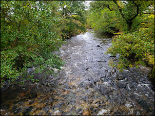
River Glenderamackin. |

Dogwood. |
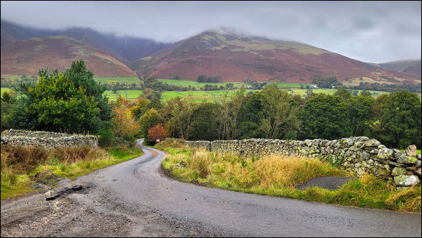
Rainy view of Blencathra. |
|
The next field took me to the River Glenderamackin where the
path continues by the river bank. Considering the amount of rain
there has been in the area the water level wasn't too high. At
the bridge to the Golf Course a woman was out walking a lot of
dogs so I waited for them to get ahead. The dogs had other ideas
and kept coming back toward me. She decided to detour into the
field so I could get past. |
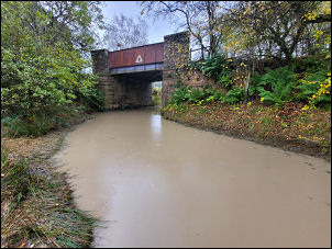
Flooded track. |

An interesting cloudscape. |
|
I continued to Gatehouse where a lot of building modification
works seem to have been done. Up the lane I left to follow an
unsurfaced track towards Birkett Field. It soon crossed under
the old railway but was flooded where it crossed under. I had to
climb the bank of the railway to get past. Approaching the farm
Buildings I noticed a lot of work was going on with a concrete
lorry and large excavator. They were concreting yard surface
area and using the machine to roughly move the concrete while
men raked it out. I couldn't figure out which way they’d got the
concrete wagon in. |
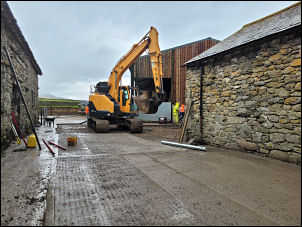
Concreting the farmyard. |
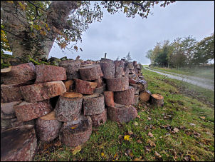
Woodpile - ready for winter. |
|
I Ieft by a path and up through a gate by a Birkett Field Farm
cottage but there was nobody around. The rain was now very heavy
as I rejoined the track on the other side. I reached another
house where the tarmac road ends. Then I headed down the narrow
lane and over the line of the old railway. To my right was a
modern house built on the line of the railway. Google streetview
has it blanked out. Down the hill I turned right into the field
to follow the path to Wallthwaite to rejoin the road. To the
south I could see the Mosedale Viaduct. At Red Syke Farm I left
the road to turn left into a field to join a path behind the
pine tree plantation. |

Looking towards Blencathra. |
|
The path took me down to the road at Wold Bridge. The 1862 map
calls it Watt bridge.This was the original road between Penrith
and Keswick before the A66 was built in the late 1960s. Across I
followed a track to a lovely arched stone bridge that would have
originally been the access to Lowside Farm. |

Threlkeld Post Office. |

Threlkeld Post Office. |
I had to cross the busy A66 again to get to the farm then bypass
it via a path up to the narrow lane where I turned left to reach
Scales and The White Horse Inn. It was now a wet and rather
dreary 2 mile walk back to Threlkeld. It was interesting to see
the Threlkeld Post Office open in what looked like a private
house.
|
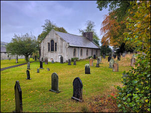
Church of St Mary Threlkeld. |
|
|
|
|
|
|
|