|
|
Lat/Long: 54.6637720, -2.9912820
OS Grid ref:
|
|
|
|
Today’s walk is relatively easy and short as the main objective
is to start breaking in my new pair of Zamberlan boots that I
bought last Mon. I set off west along the track heading towards
‘The Tongue’ and near the bank of the River Glenderamackin. It
was gloomy weather and not much above freezing with low cloud
that would prevent any higher views. |

The Tongue and stone slab path. |
|
Across the stone slabs I reached the bridge then started the
constant climb up above Bannerdale. All I could see ahead was
the base of the cloud that would block my views. I thought I’d
have the place to myself but I was soon overtaken by a
fellrunner and his dog. As he approached the cloud he seemed to
stop and I thought he may return, but he didn’t and carried on.
Once in the cloud I missed the turn for Bowscale Fell and had to
do a shortcut to regain my route. |
Bannerdale. |

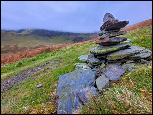
Bowscale Fell stone shelter. |
|
Once on the faint path I set off up the final part of the climb
to the cloud shrouded stone shelter wall at the top. There is
another pile of stones further on so I’m not sure which was the
true summit. My planned descent was north via Bowscale Tarn but
I followed the wrong path and soon realised I was on levelling
ground when I should have been going down. A turn left soon got
me back onto the correct route. Before long I was below the
cloud level and got some views down to Mosedale. I saw a faint
path descending down towards Bowscale Tarn so decided to try it.
It was a bit intermittent but nothing too difficult. |

Bowscale Tarn. |
|
|

Church of St kentigern. |

First walk in my new boots. |
|
Icould see walkers on the track below and by the time I’d
reached the tarn they were further along the shore and seemed to
be having a picnic. I joined the main track east and descended
steadily down to Bowscale. There I reached the road and an easy
walk back to my car. |
|
|
|
|
|
|
|