|
The early part of the night sky was clear and starry but I still
didn't see any shooting stars. There wasn't a breath of wind through
the night and I had a comfortable night. As I put some water on for
a brew I opened the tent zip and the midges appeared in clouds. So
ended my comfortable night. I had to wrap a muzlin cloth round my
face and pull my hat right down so than only my eyes were visible.
That way I was able to pack the tent down without breathing in the
midges and being eaten alive. As I wrapped the tent up they rose in
clouds from the surrounding heather and covered every square inch of
my clothes. The clear sky overnight had gone and I set off walking
under clouds. I followed the main path along the wall then turned
right to Mount Pleasant and continued in the same direction until
had descended to the road. Yesterday I had spoken briefly to a
couple of walkers who'd asked if the pub was open and they told me
to look out for May's Shop on the descent. I saw a sign saying May's
Aladdin's Cave High Gate Farm Shop Camping. |

The way to May's Aladdins Cave shop. |
|
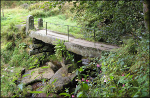
stone footbridge over Colden Water |
I wish I'd known it was this close yesterday as I'd have carried on.
The sign said it was 200m up the road so I decided not to check it
out. A path continued down the hill towards Colden Water. I came to
a path constructed of flat stones laid end to end with a worn groove
down the middle. These were the same as some I'd seen near Stoodley
Pike Monument. I reached the river and was surprised and delighted
to see a magnificent stone footbridge. Its construction was like
nothing I'd ever seen before. A central pier of large stones had two
pairs of cut stone each doubled with a narrow drainage gap down the
centre. Just downstream was a weir of large cut stones. |
|
A steep path took me out of the valley and up over Pry Hill to
Badger Lane. Crossing over the path I continued down, gently at
first, then the gradient increased. |
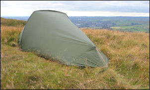
A static walker on the trail. |
|
Steep descent |
The final descent to the main A646 road at the bottom is
difficult to describe as it is a surreal series of steep steps by
old stone buildings cut into ridiculously steep hillside. My map was
of too small a scale to show the true magnificence of the feats
needed to construct the buildings. |
|
After a steep flight of stone steps the path followed a level path
for a while where I emerged onto a vehicle track and an overgrown
cemetery. There was no sign of a church but it looked like a
building had been demolished next to it. An intriguing sign pointed
to the official Pennine Way one way and the Wainwright's Pennine Way
another way. I followed the vehicle track down and under the railway
bridge to the main road. I turned right, crossed the road and along
a minor road, over the Rochdale Canal to start the climb up through
trees towards Stoodley Pike. |
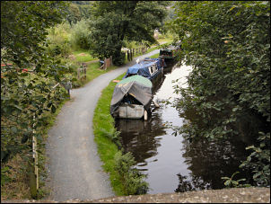
The Rochdale canal |
|
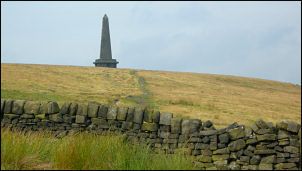
Stoodley Pike Monument |
The way marking was variable as it is primarily intended for Pennine
Way walkers doing the route from the convention south to north. I
was doing it the opposite way so had less guidance. I climbed
steadily upwards and took a path sign towards Cruttonstall. It
wasn't the Pennine Way but the name made it worthwhile. I cut across
Edge End Moor to pick up the official route again and emerge at the
magnificent Stoodley Pike Monument. |
|
The bulk of the climbing had now been done for the day but I still
had many miles to go. It had just gone 10am as I set off south with
little to see of the terrain ahead. The path was flat, fairly
featureless and monotonous. It also had various names; Pennine Way,
Todmorden Centenary Way and Rochday Way. The only positive thing to
say about the path is that it is level, easy and quick to get out of
the way. |
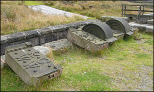
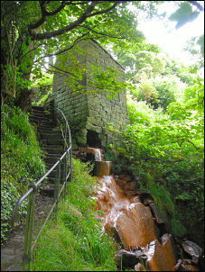
Old building remains by the reservoirs |
|
Camp on Blacksone Edge. |
I reached the A58 Halifax Road and walked a short way up the hill to
collect some water from Blackstone Edge Reservoir before heading a
short way SW to Blackstone Edge Delph to find a pitch for the tent.
It was nice to find a small patch of grass and some wind to ensure
there would be non midge problem. |