|
The rain stopped sometime during the
night and before first light the constellation Orion was visible
through the tent door. The inside of the tent was awash with
condensation and things seemed to take longer to get packed away. I
was on the road by 7:30am heading in an easterly direction for Long
Marston and then on to York. I wanted to cycle through the City
centre so just followed the recently risen sun. It was the equinox
so the sun was a good indicator of east. One of the great advantages
of being on a bike is that it doesn’t matter where you are in a
city, or how many double yellow lines or no parking signs there are
it is possible to get off and walk around to take a few pictures or
check the map and then continue on your way. |
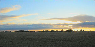
Dawn over Marston Moor. |
|

River Ouse, York. From the bridge. |
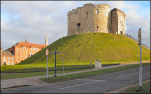
The Castle, York |
|

Windmill at Brind. |
Over the river the castle and
then city walls came in to view. I continued heading generally east
but most of the sign posts just indicated ‘ring road’ which wasn’t
much use to me. Eventually I found a sign containing the road I was
looking for, the B1228. It wound its way generally south toward
Goole and that was my next main objective. The road was flat and
only had light traffic on it making it a relief from the busy ‘A’
roads of yesterday. My only problem was the wind which seemed to be
gaining in strength. The forecast was for westerly winds but they
were coming from the south making some stretches difficult in the
headwind. But most of the time I was able to potter along at an easy
14mph which I was happy with. At Brind my small scale map showed a
windmill and I almost missed it behind the bushes. It was probably
the smallest I’d seen and was fairly ruinous but some remains of the
wooden sails were left. |
|
The main tower was
brick and reasonably intact. I continued to the small town of Howden
where I stopped for a while in the Town centre. It was very
picturesque and I bought a pork pie and slab of cake to eat by the
cross in the centre. Unlike many town crosses this wasn’t ancient
but dated from about 1909. Adjacent was a magnificent church with
half in ruins and the rest in tact and in use. |
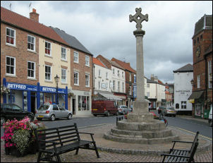
Howden and the cross |
|

Howden Minster. |

My bike and Howden. |
|
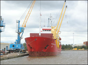
Goole harbour. |
I continued along the B1228 into Goole
which was nothing like what the map indicated. It seemed to be
mostly docks but with not many ships about. Over the river I was on
a wide eventually straight road which crossed a vast area of almost
infinitesimal fields. They were huge. I left the A161 at Eastoft and
took a delightful lane through Luddington and then to the bank of
the River Trent. I couldn’t see the river because of large
embankments. My map neglected to tell me that I was in Lincolnshire.
I followed the road south into a fierce headwind. Across the river
was Flixborough the scene of a catastrophic explosion in June 1974
which killed 28 workers on the site. I crossed over the Sheffield
and South Yorkshire canal at Keadby and joined the A18 to cross over
the River Trent. |
|
I left it to follow
the B1216 but soon found myself back of the A1077 road. Eventually I
left it to follow the B1430 into Burton-upon-Stather. I managed to
find a shop where I could buy some bottled water for my next camp.
Descending to Thealby I crossed the valley to climb steeply up to
rejoin the A1077. I turned left and got my first view of the Humber
Bridge in the distance. The road turned sharply east and I descended
half way before turning right towards Winterton. I soon turned left
where I joined the old Roman Road Ermine Street. I found a gap in
the hedge where I went into a recently seeded field to find
somewhere to pitch my tent. |

The River Trent. |