|
Roundthwaite, Bretherdale,
Breasthigh Road, Belt How, Jeffrey's Mount, Cumbria. |
|
|
NY 6092 0324 |
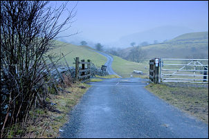 Heading into a misty Breatherdale. |
 Approaching Midwathstead. |
The lane was narrow and I’m glad I parked where I did as there were no options along this stretch of road. I took the left branch road signposted ‘Bretherdale’ and headed west towards the mist covered fells. The road opened up and in places had no wall or hedge to close it in. The road crossed Bretherdale Beck then I arrived at a group of dwellings at Midwathstead. In what looked like a farm yard was a clock fixed outside one of the buildings. |
 Midwathstead. |
|
|
|
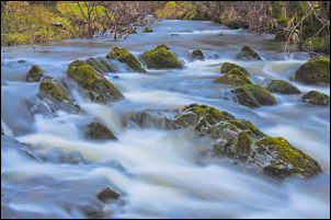 Breatherdale Beck. |
|
|
|
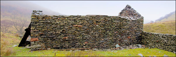 Breast High barn. |
|
|
It looked like a standard domestic clock that you’d hang on the wall inside but it was going OK. The through road turns to the right but I carried on over the next bridge to continue up Bretherdale. Although there are properties up ahead the road is now unadopted and fairly rough. At the next bridge the main track turns right but I carried straight on along the very rough and stony Breasthigh Road. In times past it was probably the main route over to the Shap Road but now only quad bikes could get through. It was still drizzly and when I reached the ruined barn of Breast High. I stopped to take a few pictures and have a coffee. |
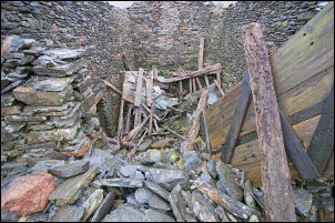 Breast High barn collapsed interior. |
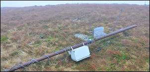 Fallen mast near Dennison Hill. |
I continued up and was soon in mist so by the time I reached the pass summit I had no views at all. I found a small depression by the track with a little shelter from the wind to have my lunch. Although the temperature was +4degC the ground surface was still frozen. This was good news as the rest of the route would probably be very wet otherwise. I headed off towards Dennison Hill following a compass bearing. There was a faint path which confirmed I was on the right track. Out of the mist I came to a fallen mast which I remembered from my last visit. It must have originally been a TV mast as a cable ran down the hillside from it. I couldn’t see any sign of the cable now. |
|
I followed the faint path through the mist in a SE direction to Winterscleaugh. There was a continuing faint path, which I followed, but soon I realised I was heading in the wrong direction. I had to use my compass to set a new bearing to cross the head of Blea Gill and reach Rounthwaite Common where I regained the correct route to Belt Howe. It’s such a shame that the weather is bad as the path is now very easy to follow and good underfoot. With some half decent views it would be an excellent walk. The final pull up to Jeffrey’s Mount was steep at first then eased. I couldn’t see it at the time but it is almost the lowest of the summits I’d walked over. A clear path headed straight down to the NE and the final descent. It wasn’t long before I could hear the M6 traffic, although it would be a while before I was able to see it. I reached a fence and followed it down to a track and back to Roundthwaite. Previously I’d seen a poster in Roundthwaite saying there was an exhibition of the Tebay Railway Steam age in St James’s Church, Tebay. I drove there to find it locked, even though the sign on the door said open 10am – 4pm |
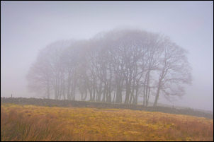 Trees through the mist near Roundthwaite. |
|
|
|
