|
Cockley Beck, Troutall Fell,
Grey Friar, Cumbria. |
|
|
NY 2471 0168 |
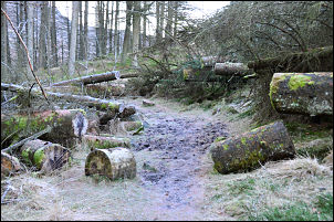 Pike How Close pine trees. |
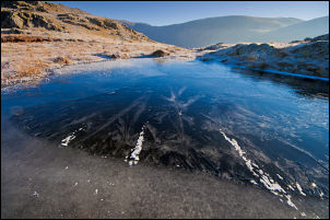 Frozen tarn on Troutal Fell. |
Over a small hill the path enters dense pinewood and a steep descent to a boggy stream crossing then out in to open fell at ‘The Close’. I headed up towards the wall and along to a gate. The main path to Seathwaite Tarn reservoir heads up to the right but I wanted to get high as soon as possible. I followed a faint path diagonally up to the left heading up Loft Rigg How. The weather continued fine and I soon reached the sun in a clear blue sky. The terrain was a delight to walk through in the fabulous weather. Even though I was in sunshine it was still cold at just above freezing. This helped by making the going was easier on frozen ground. On Troutal Fell I joined the ascent path I’d been on earlier in the week on my ascent of Grey Friar. Though it was clear and sunny there was quite a bit of haze about so distant views weren’t too good. |
|
Above Goat Crag I stopped for an early lunch and found a nice sheltered spot behind a boulder where I could sit in the sunshine and eat my sandwiches. I was look down on Seathwaite Tarn reservoir below. The original tarn was enlarged in 1904 by constructing the dam. The[duddonvalley.co.uk] website says: ‘Seathwaite Tarn. In 1904 the dam at Seathwaite Tarn was built to supply the expanding town of Barrow-in-Furness with water. The navvies brought in to build the dam rioted at the Newfield Inn and one man was shot dead, much damage was caused to the local buildings including the church where many of its windows were broken’. I continued up to the NE and the walk and views were everything I could have hoped for. When I walked this way earlier in the week I couldn’t see anything and now the views were all around. |
|
 Looking across to Coniston Old Man and Dow Crag from Grey Friar. |
|
|
Grey Friar is something special, even in bad weather. I rarely see anybody on the summit though its only half a mile from Great Carrs which gets lots of visitors. I looked across to the ridge connection Great Carrs, Swirl How and Coniston Old Man. I could see many people looking like ants on the horizon. It was too nice to leave the place just yet so I wandered around aimlessly for a while before starting a descent to the NW. The route down this way isn’t very obvious and before long I decided to do my own thing and investigate small tarns and water sources for possible future camps. In the fine weather it was delightful descent down to Cockley Beck Gill, then across open ground and back to the car near the bridge. |
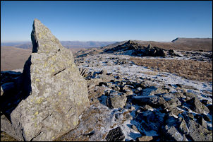 Summit of Grey Friar. |
|
|
|