|
A686, Leadate, Greencastle,
Ousby Fell, Maiden Way, Cumbria. |
|
|
NY 6796 4245 |
 ‘Danger – Private Land – Authorised Access Only’ |
 Rotherhopefell Mine. |
There is no public footpath shown on the map and this reflects on the sign ‘Danger – Private Land – Authorised Access Only’. I ignored them all and pressed on. I soon left the road and turned left on to a minor track heading over the moors towards Greencastle. The track wound through the spoil heaps of Rotherhopefell Mines then over the summit to the black looking Greencastle Tarn. |
|
Pine trees appeared before me then the buildings of Greencastle. Generally the buildings were in reasonable shape but some of the roof was going and the old living quarters were open and completely gutted inside. I headed SE across pastures towards Marland Syke. Then I followed an earthenware culvert to Cash Force Waterfall. The pipes were probably used to collect water for the mine workings below. The map showed a footbridge further up Black Burn so I headed for it.
|
 Greencastle fireplace |
 Greencastle |
|
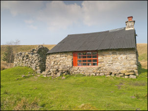 Shepherd's Hut by Black Burn. |
It appeared in the distance and so did the small hut which is shown on the map. What I didn’t expect was the great condition it was in. I peered through the window to a nice kitchen layout. Fully expecting it to be locked I tried the door. It was open so I ventured inside. It was a delightful place; clean, tidy and well looked after. I sat on the grass outside to eat my sandwiches in the sunshine. |
 The hut's kitchen. |
 Old bread bins in the hut. |
 Wide view of the hut interior. |
|
 Trainers in the hut. |
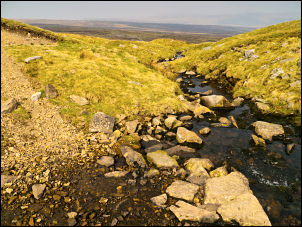
 Higher reaches of Black Burn |
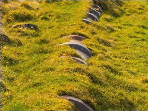
 Moth on the moor |
 View down Rowting Burn |
|
There was no path to follow as I continued up Black Burn so I picked my way as I went. I turned right up Alnwick Syke then across open moor to investigate Brandy Bottle Spring which is shown on the map. It turned out to be just a small damp depression. I followed a path for a while then left it head out across open fell to join the main maiden Way path. I was now heading generally down hill but still with several miles to go. The path was grassy until I reached the branch leading to Smittergill Head Mine when the surface changed to coarse stone and very difficult to walk on. I reached the river to find just a ford. I just managed to find some rocks to hop over but if there had been any rain it would have meant wading. The track continued up to the road then back to the car. |
 Stony Rigg tarn |