|
Lanthwaite, Grasmoor, Crag Hill,
Sail Beck, Cumbria. |
|
|
NY 1591 2080 |
 view from the ascent of Grasmoor |
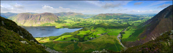 Mellbreak & Fellbarrow from Grasmoor |
|
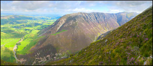 Whiteside from Grasmoor |
Higher up it is necessary to find a small path which traverses to the left and then up a steep narrow gully to reach the westernmost edge of the Grasmoor summit area. The early morning sunshine had now gone and a chilly wind was blowing as I walked from the first of a series of cairns to the summit shelter stones. The cloud had also rolled in but it wasn’t low so I still had good distant views of the Solway Firth and Scottish coast. |
|
I headed east over the summit and down to the Wandope Moss area. The main path up to Crag Hill is very obvious but I took the better minor path to the right which skirts Addacomb Hole and gives excellent views down to the valley and beck. Crag Hill has a summit trig point but I was disappointed to see that part of its base was missing. The large stones that have been used for its construction can’t possibly have fallen out on their own. Vandalism is the only explanation. |
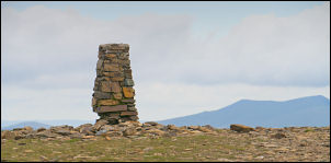 damaged trig point on Crag Hill |
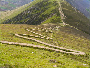 Descending Sail and the new path |
It is probably repairable but if left too long the whole pillar will collapse. There then followed a steep descent down the rocky ridge to Sail. It was bad enough on foot but as I climbed down there was a group of mountain bikers carrying their bikes up the ridge. Down from Sail is a recently made zig zag path down to the saddle where the path continues to Causey Pike. I took the sharp right path which follows down to Addacomb Beck. |
|
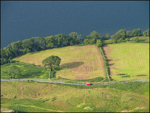
Surprisingly its not shown on the map but is a defined path but not as wide as those I’d just used. The path stays high above Sail Beck and gives impressive views down to the south and up to the road going over Newland Hause. The path is easy to follow and generally keeps to the contour. I didn’t see any other walkers but further down a group of mountain bikers were pushing their bikes up. At Grassgarth Coppice the path increases to a green track then reached the road just outside Buttermere. The rest of my walk was along the road back to the car. The weather was improving all the time I walked along the road and the sun came out again. It was nice walking by Crummock Water and at Hause Point I looked over the wall and down in to the clear water. The car park nearby was almost full and so were the parks near Cinderdale Common. When I left my car at the Lanthwaite car park it was the only one there. When I got back the park was full. |
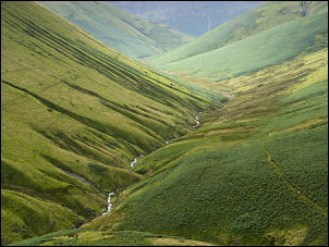 Sail Beck |
|
|
|
|
|
|