|
Ruthwaite, High Ireby, Binsey,
Cumbria. |
|
|
NY 2353 3507 |
|
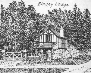
 Binsey Lodge |
|
|
When I said I was the man told me there’s a hard standing for cars up the lane to the west. I thanked him and moved my car there, which was much better. I set off north along the road towards Ruthwaite. It was raining when I set off and before long the intensity became torrential. I reached Ruthwaite and used the bus shelter to avoid the rain for a while. The sign by it said that buses hadn’t stopped there since 2007. |
|
 wide view of Ruthwaite. According to Wainwright this is where the huntsman John Peel (1777 - 1854) spent most of his time |
|
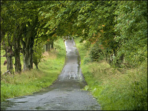 the lane from Ruthwaite |
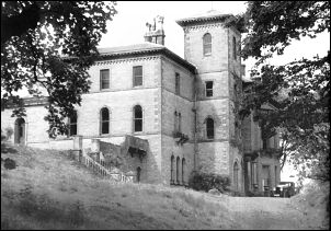
I took the tree lined lane to the west and reached an interesting stone arch over Mell Beck. The thick cloud made the adjoining woods very gloomy. Soon I came to the entrance gate to what used to be The Grange. Through the trees I could see stone steps which used to front the big house that stood there but was burned down around 1957 and all traces seem to have been removed. At High Ireby I turned left at Binsey Farm and along the track at the covered reservoir. Along the track I crossed the fantastically named Humble Jumble Gill. I now wanted to head off towards Binsey and a wall needs to be crossed. Wainwright’s Northern Fells guide says there is a stile to cross the wall but it certainly isn’t there now. I followed the wall to the SW and crossed it through a gate then another gate took me to the open fell. |
 the site of Ireby Grange |
|
|
|
 Binsey summit |
|
The summit of Binsey was lost in cloud and I couldn’t see any sign of a path leading directly there. I continued along the wall side towards West Crag and then came to a substantial path which improved to a track heading towards Binsey summit. I came to the large stone shelter and adjacent stone cairns. The trig point had its reference number S5707 highlighted in yellow and a metal plate saying it was part of the Ordnance Survey GPS network. The track continued back to Binsey Cottage and soon descended below the cloud and gave me some views to remind me that I was in the Lake District. The walk was short but must give interesting views in better weather. |
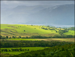 view to Bassenthwaite Lake from Binsey |
|
|
|
|
|
|