|
Martindale, Hallin Fell, Birk
Fell, Place Fell, Cumbria. |
|
|
NY 4356 1917 |
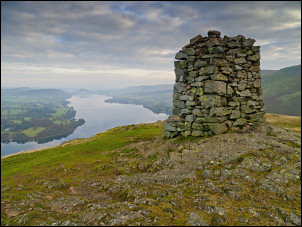 Hallin Fell Obelisk & Ullswater in the background |
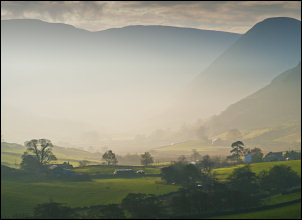 Looking SW up Boredale |
My plan was to do a traverse over the summit of Hallin Fell but the map didn’t show any path ascending from the lake side of the mountain. I followed the path to what could be called the NE ridge of the fell which I thought was the least steep way up. I left the path and started by having to negotiate deep ferns for a while but as soon as I was clear of them the climb was straightforward. The views of the Ullswater were very atmospheric because of the Autumnal hazy sunshine. Before reaching the summit I joined a path which seemed to come up from the NE. I had the summit to myself and firstly had a look at the large cairn which the map calls an Obelisk. I’ve no idea why the cairn has been raised to obelisk status. |
 the Ferry on Ullswater |
|
|
Then I descended back towards St Peter’s Church but just before reaching the road I turned right to follow a path to the north of Hause Farm then across a field to Hallin Bank. This property was empty with the curtains closed. It looked like another of the many second homes in Cumbria. The path descended along a track to Bridge End and briefly along the river bank to cross over a wooden bridge to the road to Sandwick. The path continues along a high route above Ullswater, giving very nice views of the lake. The ferry came by looking impressive with its bright red chimney. |
 looking across Ullswater to Gowbarrow Park |
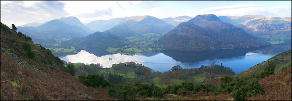 wide view of Ullswater |
|
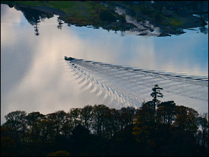 boat on Ullswater |
Reaching Silver Bay I took the path to the left which heads up behind Silver Crag. The bay is aptly named as it looks more like the sea shore than a Cumbrian lake. The path goes over a small pass, descends slightly then levels off. My next objective was a diagonal path heading up to Hare Shaw. It’s not marked as a right of way on the map but is a quite obvious path on the ground. |
|
I found it easily and followed it up. It is very distinctive but seems underused. After the first steep ascent it levels of a bit then continues up to Place Fell. It was now very windy and I struggled to get to the trig pillar to get a panoramic view. I was glad to start the descent to the north east and get some shelter from the strong southerly wind. The path is now good to follow and an enjoyable stroll. Approaching Sleet Fell I took the right branch which is steep for a while then eases. I descended to the barn near Garth Heads so I could cross Boredale Beck by the delightful stone footbridge. I walked up to the road which I followed back to the car at St Peter’s Church. |
 Boredale Beck footbridge |
|
|
|