|
The strong winds continued through the
night and to make things worse they were accompanied by torrential
rain. I was woken a few times by the noise of the wind and rain on
the tent. It was till miserable when I began to get ready. Each time
I unzipped the tent to look out a spray of rain blasted in.
Eventually the rain eased and I packed up and set off about 08:15. I
knew I would have a tough time battling into the headwind to the
south end of Loch Eriboll. It was also gusting making it very
difficult to stay upright. Turning round the loch gave me side winds
which made things difficult. Once round the loch the tailwind made
things even more unstable. I had a steep but steady climb up from
the loch then over to the head of Loch Hope. Over the bridge there
was a steep section before the turn off to the narrow Altnaharra
road which was signposted as 22miles. |
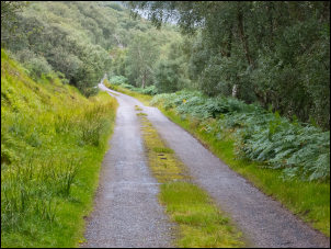
22 miles to Altnaharra |
|
There was a headwind along
this stretch but it wasn’t as bad as expected. After a few miles I
entered a forested area and was very thankful of the shelter. I also
saw a couple of deer which were the first I’d seen since the two
dead ones by the road on day one. Thankfully these were alive. There
was a little drizzle but low dark cloud overhead. It’s such a shame
as I imagined the views up to the surrounding mountains would have
been very impressive. I came to a group of what looked like holiday
chalets. There were a few cars around but no people. Further on I
came to the impressive Dun Dornaigil Broch. |

Dun Dornaigil Broch |
|
A large stone circular
structure similar to one I’d seen on the Outer Hebrides. The light
rain was now getting heavier. A steady climb followed which had
fairly steep sections where I had to push the bike. I was climbing Strath More but couldn’t see any views of it. Eventually I was on
the highest part of the pass in pouring rain. The only good thing
was I had a following wind. Loch Meadie over the summit looked
impressive but I couldn’t see the far side. |

Broch as it would have looked |
|
I began the long descent
to Altnaharra and the main A836. It seemed to take a long time to
get there and further than the 22 miles shown at the start of the
pass. The rain stopped and the weather brightened. I’d never been to
Altnahara before and was expecting a small village with a village
store. |
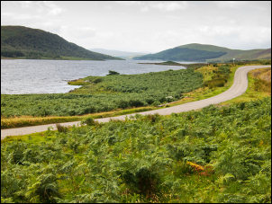
Loch Naver |
|
There was neither. Just a few houses and a hotel advertised a
short way up the road. I crossed the main road and continued along
the minor road to Strath Naver and Loch Naver. There was now some
sun which brought some colour to the surrounding hills. The road
along the loch side was remarkably flat and easy cycling, except for
the recent sprinkling of surface gravel. Before the end of the loch
I found a nice pitch with a stream nearby. It was still early but
decided to stop for the day. |
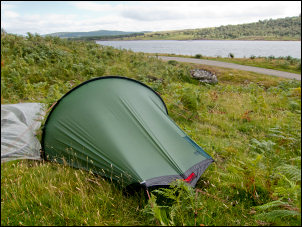
Camp above Loch Naver |
|
|