|
I could hear the high tide lapping
against the harbour wall as I woke. My camp was less than a metre
above the water level but as I was just higher than the top of the
harbour wall I reckoned I’d be OK. The sky was clear and the
temperature down around freezing. |
|
|
The sun had just reached the tent as I
was packing up but there wasn’t enough time to dry the condensation
from the tent. I walked across the car park to put my rubbish in one
of the bins then started the long ride up the hill from the village. |
|
|
It was long, straight and single track even though
it is the A884 and classed as an ‘A’ road. Eventually I reached the
summit in the trees and started a long descent. When I reached the
even longer climb of Glen Geat I was happier about the climb as it
was constant without any further descent. |
|
|
|
|
|
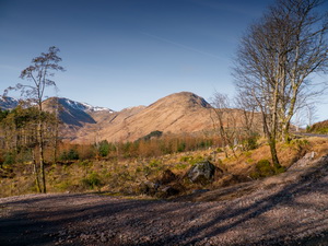
The sunny weather was also
clear, unlike last Wednesday when it was sunny but hazy and reducing
the views. It was a very enjoyable climb to the top then a slight
descent to the junction with the road to Strontian. I turned right
to head down to Kingairloch on the B8043. Considering it is a long
descent there are still several short steep climbs. |
|
|
Down at sea
level I followed the narrow road along the shore of Loch Linnhe.
Even though its an adopted road it is in a fairly bad state with
sections crumbling away and a lot of loose gravel on the surface. It
is quite interesting at first as it runs by the base of rock faces
but gets tiresome as it crosses open terrain. I reached the junction
with the main A861 and certainly appreciated riding on smooth tarmac
and 2 lanes. I had about 5miles to ride to the Corran ferry and
needed to wait for it to return from the east shore. |
|
|
I propped my
bike against the wall and walked across the road to sit on one of
the pub benches. I was on the midday ferry and the crossing only
took a few minutes. Once off I called at the toilets to fill my 2 litre
plastic bottles with water ready for my camp. I was now riding on
the A82 which isn’t enjoyable on a bike as it is narrow and very
busy. Wherever I could I rode on the pavement but they were mostly
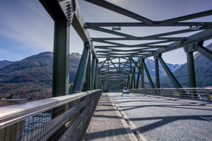
covered with gravel. Eventually I reached Ballachulish and rode over
the bridge. On the far side I found the start of the cycle track
running along the line of the old railway which used to run to Oban. |
|
 |
|
|
|
|
|
|
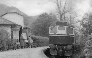
Old
Ballachulish Railway Station |
|
|
|
|
Ballachulish Railway Station before closure |
|
|
Part of the station platform was visible and nearby a good
information board about the station. The continuing cycle track made
a short detour then rejoined the old railway route along the coast.
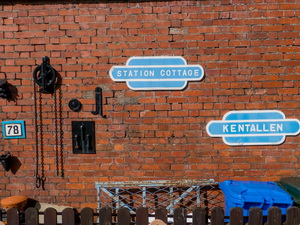
In Kentallen I crossed the road then into the housing estate where
the cycle track goes. |
|
|
|
Cycle
track along Loch Linnhe |
|
|
|
|
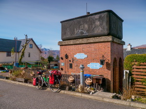
Kentallen old rail watertank |
|
|
|
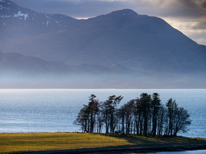
I stopped briefly at the old Railway water
tower then pushed my bike up the hill to the open ground where the
track goes. I remembered from the last time I was here that it would
be a nice place to camp. Up to my right was a nice hill that I was
able to push my bike up and not be seen from the track below. The
weather was beautiful and I couldn’t believe my luck as I pitched my
wet tent which soon dried in the sun. As a bonus I had a wonderful
view across Loch Linnhe. The clouds rolled in during the evening. |
|
|
|
|
View of
Loch Linnhe from Kentallen camp |
|
|
|
|
View of
Loch Linnhe from Kentallen camp |
|
|
|