I delayed my start until there was sufficient daylight to see. It
was sub-zero with light snow on the ground and I was concerned that
the car park was quite icy. I had a look at the road which seemed
OK. There had been several heavy lorries along the road through the
night and this helped I was on my way by 8:10 and set off heading
north to climb the pass. The going was relatively easy and when I
started the pass I set Gear 3 and hoped that it would be enough to
get me to the summit.
Tweedbank
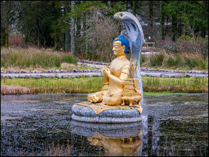
Just before the climb I stopped briefly at the Tibetan
Monastery to take a couple of pictures in the gloom but there was
nobody about. Further along the road I could see the Eskdalemuir
Meteorological Observatory up to my left but as I visited the
entrance on my last trip I didn't go there. On the climb I stopped
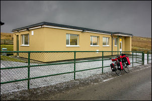
at the Seismological Station to take a couple of photos. There was a
car parked outside and lights were on inside the building.
Seismological Station
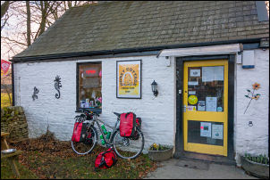
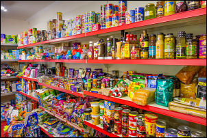
Honey Cottage shop and cafe
Honey Cottage shop
I was pleasantly surprised with the ease of the climb up to the
summit but things changed as the descent to the north as it was
quite windy and there was a thin coating of snow across the road. I
had to be very careful and kept my speed down to 10 miles per hour.
Every so often I would stop and check by putting my rear brakes on
to see if there was ice under the snow. It was a shame that I
couldn't take advantage of the excellent descent and gain some speed
but I couldn't possibly take the risk. I was aiming for Tushielaw
and would take a right turn but before that at Wardlaw is a caravan
and campsite where a small shop was open and I was able to buy a cup
of coffee for £1.10. It was nice to drink it inside and let the
feeling come back to my toes. Feeling refreshed I continue to the
turn off and turn right on the minor road that heads over to
Redfordgreen. The first part is through a spectacular valley where
the road starts to climb steadily but not too steep and up over the
summit. At Redfordgreen I stopped briefly to look at the site of the
old school that was closed in 1955. I continued on to Alemoor
Reservoirs where I stopped briefly on the causeway before starting
the climb up over the summit then the steep descent down to Roberton.
I took a left turn along the narrow road which goes between a
spectacular avenue of large trees before emerging onto open
landscape. The road was quite muddy in places but in find weather
this would be a spectacular ride as the road follows the contour
along the side of the hill. It descended down into Ashkirk where I
joined the main A7 Trunk Road. The enjoyable cycling now ended and I
had to put up with a large volume of traffic passing at high speed
much too close.
The first part of the road was a long steep climb and there was even
another one before I eventually reach the outskirts of Selkirk. I
was thankful to finish the long descent into the town and take a
right turn along Back Lane down to the Sainsbury's store where I
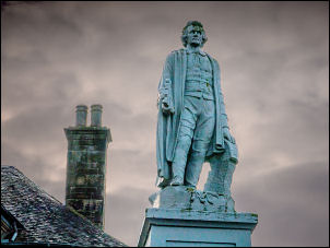
collected water. Before going into the shop I took some photos of
the Statue of Mungo Park who was born near the town.
Mungo Park memorial in Selkirk
I called at Sainsbury's and bought 2, 2 litre bottles of water at 50
p each and a small piece of bread. I cycles round the back of the
shop on through the narrow roads and steeply down to the river
following the zigzag of a one way road. At the river I crossed over
by a brand new footbridge which has been built as part of the flood
defences.
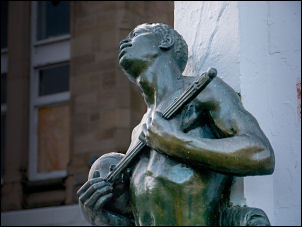
Detail on the memorial
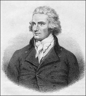
Mungo Park was a Scottish explorer of West Africa. He was the
first Westerner known to have travelled to the central portion of
the Niger River.
On the far side I stopped to look at to redundant piers in the river
and ask a man what they were. He said they were part of the old
bridge which had been washed away in the floods 18 months ago. I
continued to the road and headed north in fading light. I reach the
River Tweed and crossed over the narrow bridge which had traffic
light control. I was back on a busy road but not as bad as the A7
and continued through Caddonfoot to where I left it to take a left
turn for the minor road to Innerleithen. It is a single track road
for quite a while I had a long steady climb through the wooded area
where I'd planned to camp.
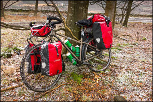
There had been snow on and off during the day but now it was snowing
steadily as I arrived at my camp spot in the trees. I got my tent up
but had to dust off as much snow as I could from the pannier bags as
I didn't want it in the tent. It was useful to have a good mobile
signal and also 4G wireless reception but there was no radio FM.
There was a long wave radio reception which works very well.