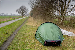
Lots of heavy rain overnight which kept waking me with the sound of
battering on the tent. Fortunately it had stopped by morning but I
still had a wet tent to pack away. I was camped by the cycle track
and it was good to see several cyclists passing in the early morning
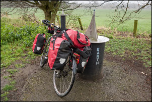
presumably commuting to work. I continued north and stopped at each
of the columns with the planets on them.
Camp by the cycleway
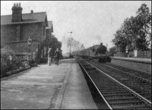
Naburn Station now
Naburn Station then
I passed in succession via Saturn, Jupiter, Mars and then Earth.
Venus was a short way on then Mercury and the Sun. At the sun I
turned right to follow the cycle track east towards York.
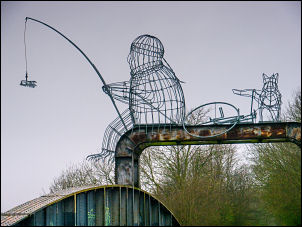
Fisherman, bike and friend
Earth
The Sun
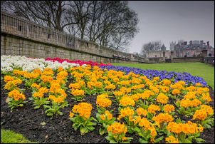
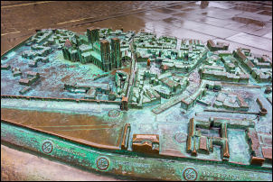
York
York Minster
Across the racecourse I
then followed the trail to the bank of the River Ouse and followed
it north to Lendale Bridge where I left the river and crossed over
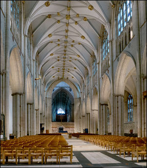
to ride through the streets to York Minster. It was raining and I
managed some photos before going inside to take a picture of the
main aisle. I continued my route out of York heading is a long cycle
trails where I eventually reach to the road at Merton.
York Minster
York Minster in the rain
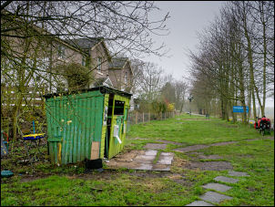
Here was the Yorkshire Museum of Farming but it was shut. Next to it
was the Derwent Light Railway but that was closed as well. I
continued to Dunnington were the cycle trail followed a rough and
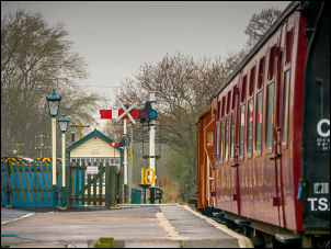
muddy track to eventually link with the old railway line to Stamford
Bridge.
Derwent Light Railway
The railway route was extremely enjoyable and terminated in the old
Railway Station. The area was open and the Station had been
extensively refurbished and platforms were intact with two excellent
information boards.
Route 66
I spoke to an old man walking his dog who told
me about the time when the station was open. He was a retired farmer
and said that coal wagons would come in to the station unload and
then be loaded up with sugar beet grown in the surrounding fields.
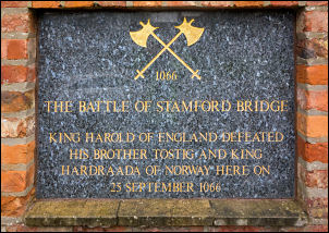
In Stamford Bridge village centre I looked at the memorial to the
Battle of 1066 then called into an adjacent Temptations cafe to use
their Wi-Fi and send some York pictures.
Stamford Bridge
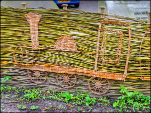
Train fence
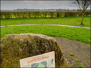
I then continued to the
actual battle site of Stamford Bridge at Whiterose Drive and is
marked on a boulder and another information board. I left the
village to the south-east and passed the Full Sutton Prison site
before turning north to join the A166 to head east. It was a very
busy road with no cycle lane and I was lucky that I only needed to
be on it for a mile before leaving on a minor Lane to Bugthorpe. The
Road continues to Kirby Underdale and after that I had to struggle
up a very long and steep climb.
Stamford Bridge 1066 battle memorial
The first part was so steep I had to
get off and push but after that managed to get to the summit where
there was a left turn and shortly a right one taking me towards Thixendale. A steep descent took me down to Thixendale where the
road followed an interesting valley taking me east where there was
the line of an old railway to my left. I follow this down a steady
descent to Fimba. Although the weather continued very overcast
cycling was enjoyable as I had a steady southwest wind giving me
some assistance. At Fimber the road was quite busy being the B1251.
Stamford Bridge 1066 battle site
I followed it to Fimber Grange and crossed over to continue along
the valley where I started the long steady climb to Sledmere House.
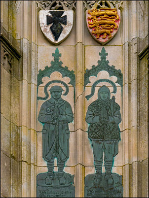
This is a large country house with gardens that are open to the
public. On the approach I could see two war memorials which I
stopped to photograph. The second one had some very interesting
carvings depicting World War 1 and various atrocities committed by
the Germans. I had a quick look in the Sledmere House car park where
I could see many cycles parked outside the cafe.
Sledmere War memorial
Sledmere War
memorial
Sledmere War
memorial
I headed north
through the Yorkshire Wolds in to Helperthorpe and then on to
Weaverthorpe. I stopped at a very small Methodist Chapel which was
built of brick but unfortunately was locked. An outside door says
Wesleyan Sunday school 1914. I continued through Butterwick to
Foxholes where I was heading north on the B1249 and then turn right
on a minor lane along North Cotes Road. Although it was a steady
climb it was very enjoyable as there were no hedges both side and I
could see the extensive cultivation of the surrounding fields.
Trig post
At
the summit I turn left and stopped briefly buy an Ordnance Survey
post before descending steeply down to Fordon where there was
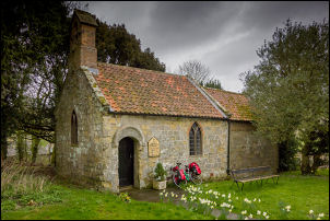
another small church but this was very old but I once again was
locked. I turn right to follow a delightful valley called Cans Dale
until I reached the end and turn left to take me into Hunmanby. I
reach the busy A165 and headed north west to a roundabout where I
was able to leave the busy road and follow a quieter road into Filey.
Fordon Church
I firstly headed for the railway station hoping to buy a ticket for
tomorrow. I couldn't find a ticket office and ask a taxi driver
outside if it was open. He said there hadn't been a ticket office at Filey for many years. This could be a problem for my planned return
tomorrow. I cycled on to the Sainsbury's supermarket where I bought
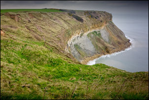
some water and then continued to the coast at Filey Brigg. My
original plan was to camp at Filey Brigg but as I was unsure about
tomorrow's train ride I decided to ride along the Cleveland Way
clifftop path to get a little closer to Scarborough.
North Sea coast
The track was
grassy and quite rough but I decided to ride a couple of miles to
the caravan park at Cliffe Farm. It looked as if I would have access
to the road so I found a decent camp spot at Cunstone Nab and put
the tent up just as the rain was starting.