Glasgow, River Clyde, Monkland Canal, Airdre, Union Canal, Falkirk
Tunnel, Edinburgh, Scotland. (3 day
bike ride)
(3 day bike-pack)
Tue 27 Mar - Thu 29 Mar
2018
Set off on bike at 05:30 and cycled through the dark and rain to
Preston Railway Station. I’d previously bought an advanced ticket
costing £10.55 to Glasgow on the 06:40am train. The train was on
time with the bike area at the front of the train. I was able to
strap my bike in by just removing the front right pannier. Last time
I was instructed by the guard to take all my panniers off and hang
the bike from a hook on the roof. With no other bikes on that’s
pointless. The journey was enjoyable as I sat, read and looked out
at the passing countryside.
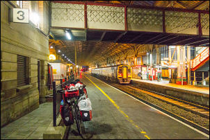
About to leave Preston
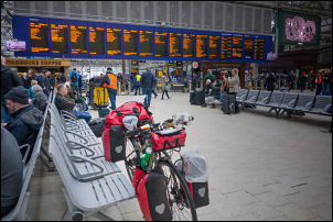
Arriving in Glasgow
We arrived around 09:20am and I wheeled my bike to the front
entrance of Glasgow Central Station. It was raining. I still had my
full waterproofs on from the ride to Preston so set off south to
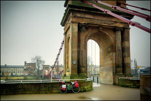
join the cycle track along the Clyde. Previously I’ve always turned
right to follow the river downstream. For the first time I turned
left to head upstream. I hadn’t been going long when I stopped by
one of the first bridges over the Clyde the South Portland
Suspension Bridge 1853. It was now pedestrian but in those pre-car
days would have taken all the traffic.
1853 bridge
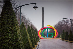
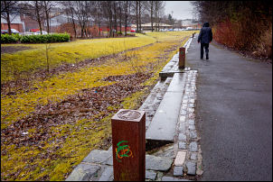
I continued to a large park area and monument to Nelson then back to
the Clyde. Tree felling operations were underway but I was able to
push my bike round the vehicles. The Clyde meanders for a few miles
then became none tidal and some areas with dumped rubbish.
Through the park
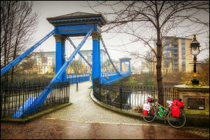
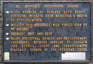
St Andrew's Suspension Bridge
St Andrew's Suspension Bridge
Under the M74
Under the M74
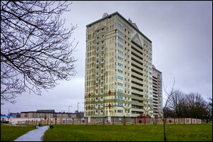
I cycled under the M74 then up onto another length of cycle track. I
left the river on the approach to Uddingston and came to an
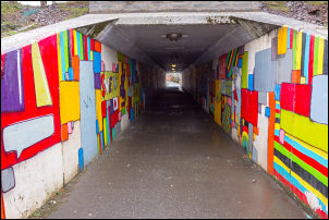
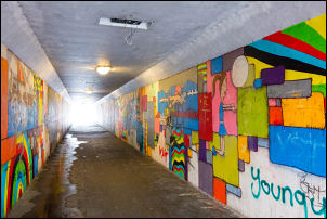
interesting pedestrian underpass to cross the M74 for a second time.
Only one light had been smashed by vandals and the walls were
painted in interesting murals. I headed north towards Coatbridge and
using a very muddy track came to the towpath of the Monkland Canal.
Monkland Canal
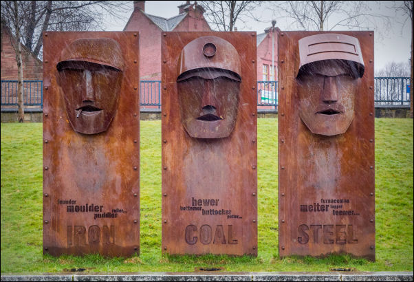
The Monkland Canal gave Glasgow access to the mineral resources of
North Lanarkshire. It was projected to provide the city with a
plentiful supply of coal. James Watt began work on the canal in
1770. Work was finally completed by William Stirling & Sons of
Glasgow in 1789. In 1790 an Act of Parliament allowed the
construction of a junction between the Monkland and the Forth and
Clyde canals by a cut from the Forth and Clyde basin at Port Dundas
to the Monkland Canal basin. The Monkland canal was bought in 1846
by the Forth and Clyde Canal company (taken over by the Caledonian
railway in 1867). The Canal was closed to commercial traffic in 1935
and was abandoned in 1950.
Drained Monkland Canal
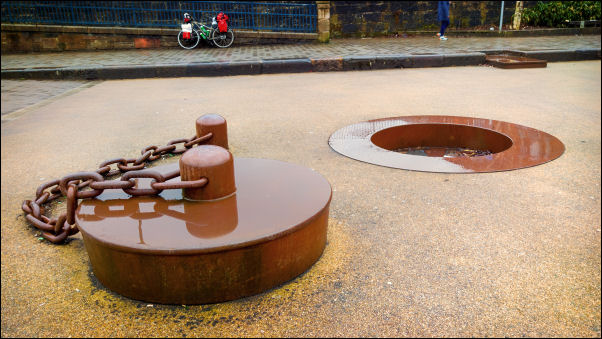
It had water in it but as I continued east it was blocked off and
had been drained and the towpath retained. I came to a large old
basin area in the town that had been drained and a feature made of
it with a large steel plug in the bottom. Leaving the town I
continued along cycle trails and the light rain continued. Part of
the route was along an old railway and I continue into Airdrie where
I stopped to buy some jam doughnuts to keep me going and 4lt of
water for tonight’s camp. It was still only 1pm so reckoned I’d have
enough time to get to the outskirts of Falkirk.
Approaching Coatbridge
Coatbridge basin
Coatbridge
For a while I was on a very busy road but thankfully came the cycle
track that took me along the side of the railway into Caldercruix. I
turned left onto the road to head out into open countryside to
Limerigg. I was disappointed by the huge amounts of rubbish thrown
along the side of the road. Each layby also had piles of rubbish and
old fridges dumped in it. I turned north in Limerigg and headed to
Slamannan where many of the buildings are in a sorry state giving
the impression of a depressed village. I continued north where I
could see large radio masts in the distance.
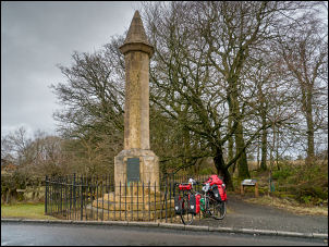
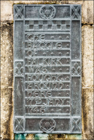
Memorial to the battle of Falkirk Muir 1746
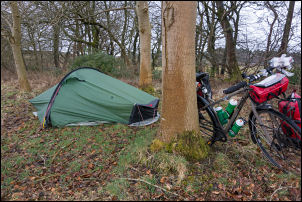
Camp
on the battlefield
1746
It was empty open countryside and not very interesting. On the
outskirts of Falkirk I turned left to reach the monument that marks
the 1746 Battle of Falkirk Muir. The adjacent information board
about the battle was confusing because the map didn’t have a north
point. The description was wrong and I suspect it was intended to
look the other way. Just to the NE was an area of open field so I
wheeled my bike there and set up camp. The rain had stopped but
started again shortly after I got the tent up.