Before sunrise there was a red glow in the sky behind Keswick to the
north but it soon vanished at sunrise which wasn't visible from my
camp. Faint sunshine reached Great Gable after sunrise but dark
clouds soon rolled in. The weather report said rain mid-afternoon
but I could feel it wasn't far away. As I packed up the tent shortly
after 7am the rain arrived but wasn't too heavy. Once underway I
passed Lambfoot Dub which was getting the surface whipped up in the
wind. I climbed up in to the high valley below Great End but
couldn’t see anything as the cloud had descended. I kept to the
right of the river and up the grassy bank until I reached the base
of the rocky edge.
I was able to follow the base the side of the gorge to find a
safe way that looks like it’s being used by walkers. I reached to
top of the saddle but was still in cloud and rain. I continued
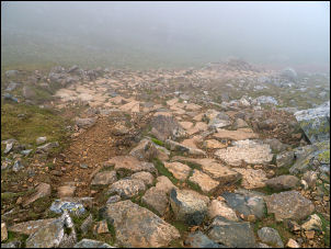
straight over the top to start the descent into Calf Cove. I was
here in the winter and had to descend a snowfield. Now I could
follow the path down which was a well-made zig zag of stone steps.
Stepping down to Calf Cove in the rain
At the bottom I followed the stony path down through the cloud and
rain to Esk Hause shelter walls. I stopped to change from my wind
jacket to blue goretex jacket then set off up and over Allen Crags.
With continuing cloud and nothing to see I just continued on
catching a glimpse of High House Tarn where I'd camped many years
ago on a previous walk.
Esk Hause wind shelter
Approaching Glaramara I didn't climb over the rocky summit but tried
to find a way down by the alternative path that circuits the summit
base. I reached the main path to Thornthwaite Fell which is well
defined but my route was to branch off to take a descent route to
Hind Gill. There is nothing on the ground to show the junction and
even the path is undefined though it si marked as a green dashed
line on the map. The weather cleared a bit and I was able to see the
terrain below. There were a few possible camp sites but I wasn't
sure if I'd be able to get a signal for my phone. I could just see
Derwentwater and Keswick through the cloud and assumed there would
be a mast there. The first possibility turned out to have no signal.
After wandering in the rain and strengthening wind I found a faint
signal and pitched the tent. I had an interesting walk along the
contour to reach Hind Gill and a water supply to fill my 2, 2lt
water containers.
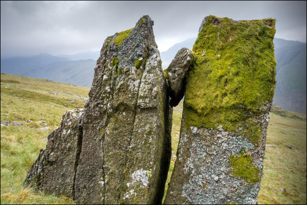
Interesting boulders on my way to collect water from Hind Gill
I could see Seathwaite below and there was the temptation to
continue my descent to the car but I'd paid for 2 nights parking at
£8 per night and I wouldn't be able to get a refund so decided to
stay. I pitched the tent in the strong wind and retreated inside.
The faint mobile signal I could occasionally get turned out to be
Gosport and not Keswick.