|
With lots of traffic he couldn't stop long so I had to be quick.
By the time I got my rucksack sorted and on my back most of the
traffic seems to have dispersed. I returned to the sharp
junction and turned left onto Market Street and walked along to
the Co-op building. I turned right here to cross over the River
Calder and then the Rochdale Canal. |

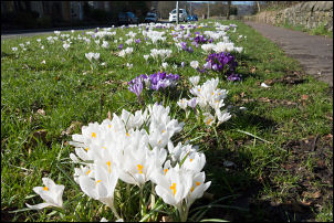
Start of my walk in Hebden Bridge. |
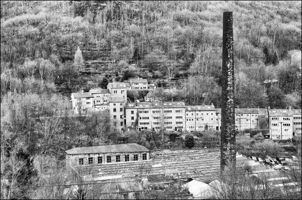
Looking down on Hebden Bridge. |
|
Then I started the very steep climb up New Road which joined
Horsehold road and continued steeply up. Eventually I reached
the farm buildings and Horsehold road and very tidy cobbles. The
road changed to Broad Lane and continued up to a crossroads
which seems to be the end of the adopted road. I turned right on
a level track which was quite rough in places to Erringden
Grange Farm buildings and on to the end of the lane. Through the
gate I was soon out on the moor on the more and up the past
towards the plantation. |

This is still the adopted road. |
|
Through another gate I had an impressive view of Stoodley Pike
monument in front of me. I followed the path up to the monument
and left my pack while climbing the spiral staircase. Once
inside it is very soon pitch-black so used my light to see the
staircase. It only goes part way up to a viewing platform. This
is the second monument on the site and the first was erected in
1815 to commemorate the defeat of Napoleon but it fell down some
years later in 1840 after a lightning strike. |

Stoodley Pike monument in the distance. |
|
The current monument was completed in 1846 and opened at the end
of the Crimean War. It is extremely well built and has weathered
the decades well. There were a few other walkers about but not
as many as I would have expected. The weather continued calm but
cloudy and there was hardly any wind. I am now on the Pennine
Way footpath and I continued across the moor heading towards
Langfield Common. I met a few people on the way and we exchanged
greetings. One couple stopped to chat for a while and seeing my
pack assumed I was walking the Pennine Way. The path was quite
good but eventually improved considerably as it had been
upgraded using Mill floor slabs. There were occasional minor
paths crossing the way which were the ancient stone slabs for
the mill workers many years ago. |

Stoodley Pike Monument entrance. |
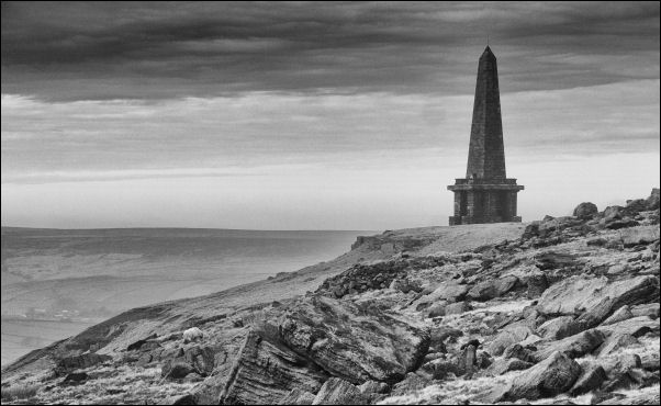
Stoodley Pike monument in the distance. |

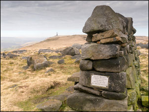
Monolith |
Memorial Rest seat. |
|
Away in the distance I could see the wind turbines on the Moor
top and some of those is where I am heading. I came to Warland
Drain which is an interceptor ditch to collect water for the
reservoirs. It is well constructed of stone but very overgrown
and has not had any maintenance. Eventually I reached the intake
to Warland Reservoir where I decided to take The descent path
straight down to Bottomley and the Rochdale Canal. The weather
had improved and the sky was almost clear with warm sunshine as
I descended the path across the more. |
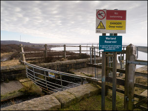
Warland Reservoir. |
|
Soon there were marker posts with yellow on the top. All seemed
well for a while but then the market posts took me away from the
path route marked on the map. I decided to leave it and join the
path route on the map which meant crossing very rough ground.
When I reached what I thought was the correct line there was no
discernible path. I didn't have far to go before I could see the
first buildings where the path continues. As I reached them the
yellow markers came down the hillside and it appears the marked
route is a diversion. |

Rochdale Canal. |
|
At the buildings I followed their access track down and was soon
on a unsurfaced track down to a remote house of Meadow Bottom
Cottage. After passing it I descended a very steep path down to
more buildings where the route goes through what would have been
the original farm yard. Some men were working here resurfacing
the road and I stopped for a brief chat before descending the
steep path which was a cobbled path down to the canal bridge and
the summit of the Rochdale canal. I reached the canal bridge and
lock gates by Bottomley and rested for a while. I was directly
adjacent to the main road which I crossed over and headed up a
footpath onto the Rochdale Way. |
Verge |
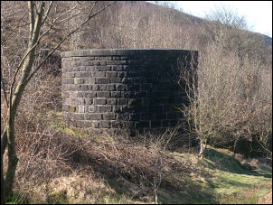
Railway vent shaft. |
I turned right up the
|
|
It climbs up to a circular stone structure which is one of the
air shafts on the railway. the path continued up and was soon
surfaced with large cobbles spanning the full path width. higher
up I came to a farm track and turned left to continue towards
ready Reddyshore Scout. At a river crossing I turned right to
follow a indistinct path up onto the moor which is the
continuation of the Rochdale Way. I wasn't far from my planned
camp and kept an eye open to check the river for a water supply. |

Workers path across the moor. |
|
There was a wall on my left and across the fields the Reddyshore
Farm buildings. I wanted to camp out of sight of the buildings
so continued up following the small stream and then up into a
rocky outcrop which was an impressive site to camp. I was almost
out of sight of the farm buildings. The stream was surprisingly
clear as I collected water but I still boiled it anyway. |

Camp 01 |
|
|