|
|
|
The rain continued
into the night but at some point it stopped because when I poked my
head out of the tent door at 5am I could see Pen-y-Ghent across the
valley. I made a start on breakfast right away to try and get
underway before the rain came back. I managed to get the tent down
and on my way by 7am but the cloud and rain was faster than me. Once
again I was climbing through the wet mist in full waterproofs. I set
off NE, following the wall and aiming for the trig point. It wasn’t
on the wall line but I could just see it at the limit of my
visibility. As I set off to investigate I looked back and saw
another similar trig point like outline over the wall. |
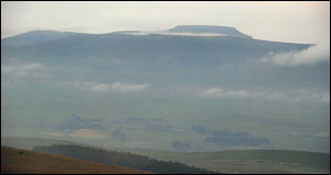
Morning view of Pen-y-Ghent. |
|
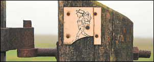
The gate post at Horse Head Pass |
The wall was too high
to investigate so I left it and re-joined my route ahead. The grass
was horribly wet and I was soon walking in squelchy socks, at least
the wind wasn't too bad. In good weather this must be a spectacular
walk but there was only a sheep track to follow, indicating that few
walkers come this way. The wall was the only guide I had and I often
wonder about the men who built the thousands of miles of these
magnificent monuments. Now, when a piece of wall falls down after
centuries of no maintenance, all the landowner can do is put up wire
fences. Repairing a wall is beyond the skill of most these days. I’d
made the right decision to camp where I did yesterday because when I
arrived at my planned camp of Robin Hood’s Well I couldn’t see
anything over the wall. |
|
I didn't venture
inside the church but hope to someday. After another stretch of easy
road walking I arrived in Buckden. The village green looked nice and
the two seats were a good spot to sit for a while. |
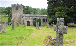
St Michael's Church, Hubberholme. |
|
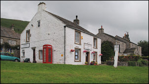
The village store in Buckden |
The shop was
picturesque and I thought I’d take a photo. Just as I'd taken it a
very angry man burst out from the shop and demanded to know what I
was doing. I was stood there with a camera in my hand and thought my
actions were obvious to anyone with an IQ of greater than one. I
told him I was taking photos, 'What are you taking them for?' he
asked. Now I was annoyed at his rudeness. Stupid and rude must be a
local problem. He returned to the comfort of his local shop and I
walked on. At the car park I saw the bus and spoke with the driver
for a while. He had one passenger and apologised for not being able
to chat longer but he had to be on his way as he had a timetable to
maintain. |
|
I took the old quarry track that runs
diagonally up the dale side. At the top I followed a deteriorating
track that took me up the Buckden Beck valley side to the old
disused Buckden Lead Mine. The entrance to the mine was a stone arch
and surprisingly wasn’t blocked off. I climbed steeply up and came
to a rough path that I followed to the summit of Buckden Pike. I’d
planned to camp here but there was no decent water to be found. Just
a couple of ditches with shallow black water. I had a quick look at
the eroding trig point and returned along the ridge heading south. I
came to a memorial cross but because of wind and rain couldn't take
a decent photo. Still no water was to be seen so I carried on. I
hadn't descended too far when I came across a ditch with rainwater
draining into it. The ground was reasonably flat so I decided to
pitch my tent. The rain began to fall even heavier and I just got
into the tent as the weather took another turn for the worse. |
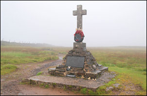
The memorial was erected in 1973 in
memory of
five Polish R.A.F. airmen who died here
on 31st Jan 1942. There was one survivor. |
|
|