|

Crossing Newbiggin Crags. |
I went a bit further
along the lane and tried again before Town End Farm. I followed a
wall and fence line steeply up and after a left turn at the top
found a gate which lead to more open ground. It was tied shut with
rope and covered in barbed wire. It was difficult climbing over but
once on the other side I joined a nice path which took me to the
wall that heads over the limestone summit. I'd just got on the top
when I noticed my map was missing from my pocket. It had probably
dropped out while I negotiated the barbed wire so I left my pack and
retraced my steps back to the gate. I was right, but I had to climb
the gate again to retrieve my map. It didn't take long to return to
my pack and start walking again. It was still cold but a clear sunny
sky made for pleasant walking. Ahead I could see a land rover parked
near the wall. When I got there it was a man and woman who were dry
stone wallers and repairing a gap in the wall. I stopped for a brief
chat and it turned out they were on the fells above Ennerdale south
shortly after I'd seen the helicopter bringing in fencing materials
earlier in the year. |
|
The helicopter lifted
a porta-cabin and supplies for them so they could stay up there fore
quite a while and rebuild the gaps in the stone walls. I continued
and reached the road where I sat on the stile for a well earned
rest. Further up the road I turned right to follow a path. The swing
gate was too tight for anyone with a rucksack to get through, so I
had to climb over it. The path was initially in the open but then
followed a muddy track through trees and gorse. Not the best kind of
walking in full pack. I emerged to sunny limestone pavements and
descended steeply down to Hutton Roof where there were quit a few
houses. I still had a long way to go so followed Gallowber Lane all
the way to the A65 road. I turned right by the garage then left down
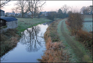
into Kirkby Lonsdale. I passed through the town and down to Devils
Bridge over the River Lune. The cafe cabin was open so I had a
refreshing cup of tea out of a proper mug and not a plastic cup. It
made all the difference. Walking along the A683 wasn't nice as once
again there was no path or verge. Even the narrow minor lane through
Casterton wasn't without its problems as I had to squeeze up by the
hedge to let a large car through. I continued on until I was
climbing steeply up the fell road towards Bull Pot Farm. I'd planned
to camp near the high road and fortunately found a stream passing
under the road at the right place. I went through a gate into the
field on the right and climbed to a small hill nearby. It made a
very nice grassy pitch with excellent views. I arrived at 14:30
after a long walk of 21.5km |

Devils bridge Kirkby Lonsdale. |