|
Through the night the rain was
constant and occasionally torrential. Fortunately it had almost
stopped by morning and as I packed the tent away I was treated to
the sight of a wonderfully vivid rainbow, well half of one actually.
There was still quite a bit of cloud swirling round as I headed
directly up the hillside to the summit of High Raise. I took a quick
picture of the summit trig point in the mist before heading for the
descent to Greenup Edge. |
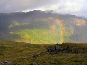
Morning rainbow |
|
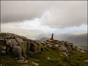
Low White Stones |
The cloud cleared a
bit and the views started to open up. At the summit of the pass I
rurned right to descend to Withburn. The map shows a path heading
off down into the valley but there is no path other than the main
one descending towards Grasmere. I followed it down to the head of
the valley and picked the best route I could across the unbelievably
wet and boggy ground. Eventually a sort of path appeared. It was so
wet and muddy I can’t think of any way to describe it. Even lower
down it didn't seem to improve. On the final approach to Steel End
the valley widened into fields and the last stretch was a flat walk
to Stockhow Bridge and the road. |
|
It was so nice to
be away from the horribly wet ground that the tarmac of the road was
a comparative luxury to walk on. I had second thoughts when I
reached the main A591 road and the very busy road with no verge and
no footpath, just stone walls both sides. It wasn't too far to the
Wythburn Church turn off but it was very uncomfortable walking
towards huge vehicles approaching at speed. |

Wyth Burn |
|
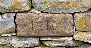
Datestone on the A591 |
At the turn off I stopped to check the
date stone of 1916 in the opposite wall. I'm sure it has gone
un-noticed by most of the people passing this way. My main objective
was now to recover the food depot I'd left last Sunday. I'd buried
it under a pile of boulders in the dense woods. I found the spot
easily and retrieved the sealed bag. The gas cylinder was obviously
intact but the food bag had been nibbled through by some rodent.
Fortunately the contents were intact. |
|
I walked the short
distance to the car park and ‘pay for meter’. I found it highly
amusing that a sign 'Ticket Machine out of order Sorry for any
inconvenience!' was fixed to the meter. It's not inconvenient for
anyone wanting to park here. How can any organisation charge for a
parking area with no facilities whatsoever? I had some rubbish but
will have to carry it over Helvellyn because United Utilities can't
be bothered to provide a rubbish bin, but they want your money to
leave your car here. They don't even provide a bench to sit on. I
found one next to Wythburn Church, probably financed by the church.
There were now a few people about as I set off up the path towards
Helvellyn. |
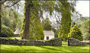
Wythburn Church |
|

Helvellyn summit shelter |
The first section
ascends through pine forest then into open ground with a well made
stoned path. It was straightforward all the way up until I
approached the junction with Nethermost Pike. Approaching was a
woman and dog. I recognised her as Ruth from a trek I'd been on in
2001 in Northern India. As I approached I looked at her and smiled
but she looked at me blankly, like a stranger. I wasn't sure if she
didn't remember me or didn't want to. I decided to leave it and
carry on. |
|
Approaching the
stone shelter of Helvellyn summit a man was coming down and asked me
it if I'd come from Grasmere. He wanted to know the way there. I was
appalled that he didn't seem to have a map and was asking the way.
He was asking for trouble if you ask me. Many people were sitting
huddled behind the shelter stones but I carried on to the summit
trig point. I didn't stop but started to descend in the direction of
Brownrigg Well, the highest spring in England. Within 10mins I was
there. Since my last visit someone had built a small stone cairn. |
|

Brownrigg Well |
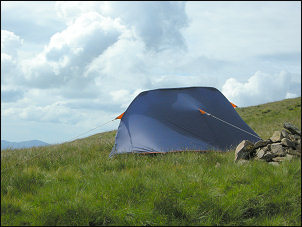
Pitch on Helvellyn by Brownrigg Well |
|
|
|