|

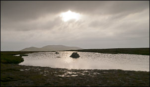
View to High Pike just before sunrise |
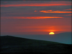
Sunrise above High Pike |
|
The wind died down during the night
and the sky was partly clear. The forecast was for a clear sky but
that turned out to be wrong although the temperature did drop to
4degC. I just caught a brief glimpse of the sun as it rose above
High Pike to the NE but that was it for the rest of the day. The
cloud rolled in and for a time enveloped my camp. I started the
squelchy descent towards Miller Moss just before 7am. It was an easy
and pleasant descent and at Grainsgill Beck I joined the Cumbria Way
path to descend by the beck. The path is stony in places but
improves when the old mine workings are reached. |
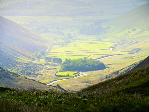
View to Mosedale |
|
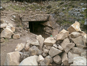
The refurbished mine entrance |
The mine area is desolate and deserted
and it’s hard to imagine that when I passed this area 30years ago
the mine was being worked. I was surprised to see one of the lower
levels had been cleaned out and a shiny new stone portal
constructed. The outlet had been piped to allow drainage water to
return to the beck. There was no information board around to explain
who was doing the work or why. The wide flat valley of the River
Caldew was spread out before me. A campervan was parked in the first
grassy lay-bye I came to but the blinds were up and presumably the
occupants asleep. |
|
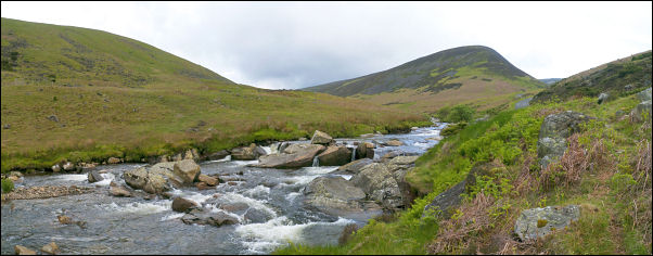
River Caldew and Coomb Height |
|
The river is fairly deep and fast and
I needed to cross it. I didn’t have long to walk to reach the first
footbridge at the Roundhouse properties. Over the bridge was a green
path heading straight up the fell side. That’s the way I was heading
so I followed it. The map doesn’t show it even though it must be
well used. It was heading in the general direction of Bowscale Tarn
but I left it to turn right and follow another old route up towards
the crags above. After a steady climb it became steeper for a while
then flattened out to give impressive views down on to Bowscale
Tarn. |
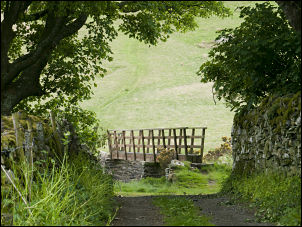
Approaching the footbridge at
Roundhouse |
|
A better defined path took me to the
double summit of Bowscale Fell where I met a walker and his dog by
the cairn which I judged to be the lower of the two summits. The
next was only a minute away and as I arrived so did the walker but
he slumped in to the stone shelter there and seemed happy to get out
of the wind. I pressed on as I could see the path showing the way
ahead towards Bannerdale Crags. It wasn’t the crags I was after but
the path to the right which goes to a saddle on Mungrisdale Common.
It was interesting looking up to the profile of Sharp Edge above me.
I took the steep path up the ridge towards Atkinson Pike but had no
intention of following it all the way. |
|
Small Tarn near Atkinson Pike |

One of the crosses near the
summit |
|
My objective was a
pitch between Atkinson Pike and Blencathra but to get fresh water I
needed to call at a stream which I’d reach by doing a traverse at
the 750m contour. It was fairly easy going and after a while I found
a faint path to follow. The stream appeared before me and had a
couple of issues coming straight out of the fell side, indicating
clean water from underground. It would have made a good camping spot
but there wasn’t any ground flat enough to get my tent on. I filled
my water bag and headed steeply upwards. I didn’t particularly want
to camp directly on the summit as it would be too close to the main
footpaths. I climbed up and kept a lookout for the first flat spot.
It turned out to be near the top and closer to the footpath than I
would have liked. Fortunately the ground wasn’t too stony and I was
able to get all the pegs well in as I pitched the tent. By now it
was mid-day and I hadn’t been in the tent long before a group of
Geordies appeared outside the tent and one asked if it was OK to use
the tent to shelter from the wind. Of cause I said it was but I’d
hoped for some peace a quiet. Later in the day I went for a walk
along the ridge to Atkinson Pike and a look at the various crosses
formed by stones set in the ground. I saw three; two were white
stones and the other just grey. The weather continued overcast and
grey with spots of rain. |
|

View down to Scales Tarn |
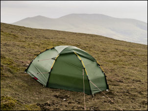
Tent on Blencathra |
|
|