|
As I drove north along the M6 motorway
the windsock at Tebay was showing quite a breeze but not too bad. I
left my car on Brundholme Road, Keswick and set off back to the main
road. I turned right then just before the main roundabout found the
small path down to the left which ran along the line of the old
abandoned railway. It was quite muddy in places but the mud wasn’t
too deep. I came to a bridge where I decided to leave the track line
and join a road track below. I walked along the side of the cemetery
then on reaching the church turned right to follow the line of the
old road towards Portinscale. |
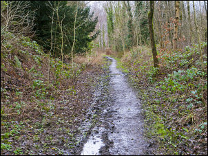
The old railway line near Keswick |
|
It is now only a muddy path but on
reaching the B5289 I crossed over to continue along the same route
but now it is still a road, even though not a through road anymore.
I crossed the pedestrian suspension bridge and entered Portinscale. |
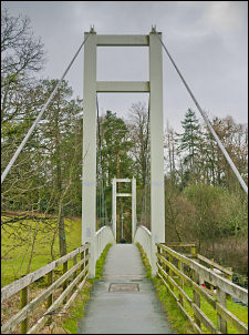
Footbridge at Portinscale |
|
At the road junction I turned right
were I came to the interesting feature by the roadside where a
couple of stone arches have inscriptions on them. The largest says
Dorothy + Well. |
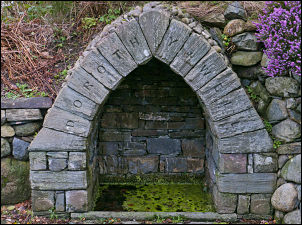
Dorothy + Well - Portinscale |
|
The other is smaller and has text
which is indistinct. Further on I crossed the main A66 road and
headed up a lane which ended and continued as a very muddy path over
Hodgson How. Judging by the avenues of trees either side it must
have been a road or track many years ago. |
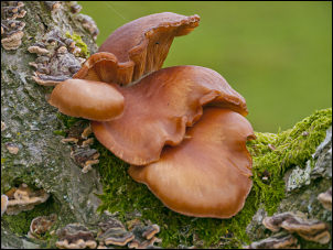
Fungi on Hodgson How |
|
Below I could see the War Memorial
which was my next stop. Just before it is a stone arched bridge with
nothing underneath it. The river course must have moved many years
ago. The memorial was a single Celtic cross on the top of a small
natural mound and surrounded by trees. I rejoined the line of the
old abandoned road for a while, re-crossed the A66 and walked in to
Braithwaite village. |
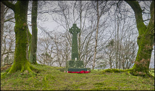
War Memorial near Braithwaite |
|
Just after the village I took the path
off to the left and followed it to the vehicle track to Force Crag
Mine. The track had fresh vehicle tracks on it and after I’d gone
about a mile a truck came up behind and sounded his horn. I couldn’t
hear his approach due to the severe head wind which was very
difficult to negotiate at times. Along with the wind was drizzle and
low cloud. I could see enough of the path high up and driving rain
to realise I would have to be careful choosing my camp site. At the
mine there were quite a few vehicles dotted about and a couple of
surveyors were walking across the spoil heaps. I can only assume a
satellite survey receiver station I saw earlier mounted on a tripod
is linked as they had a survey pole and receiver dish attached. The
stepping stones across Coledale Beck were all underwater and I had
to cross with care. |
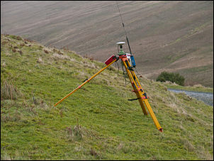
Satellite survey receiver |
|
As I headed up the path a couple were
coming down and warned me of the winds high up. The track I was on
was the access to the long abandoned High Force mines. At the top of
the rise I stayed on the left side of the river to head up towards a
high valley below Crag Hill. The map shows a sheepfold in it but I
soon realised that to go much higher with the winds as they were
would be foolish. At a point where the river begins to rise again I
noticed another sheep fold. I walked over to investigate and decided
that camping with its walls would be the safest option. It was still
incredibly windy but I managed to get the tent up between lulls in
the wind. In the early evening I went out to check the guy lines and
found a couple that had pulled loose so they were sorted before
battening down for the night. |
|
|