|
It was a very calm night but still
overcast. There was a short rain shower but it stopped before I
packed up and set off at 7am. |
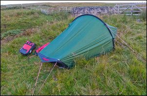
Camp 1 |
|
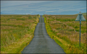
The road ahead was straight and
undulating like a big dipper. |
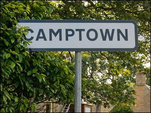
Into the Scottish Borders |
|
Soon the steep descent started and
after a few sharp bends I suddenly reached the delightful village of
Newcastleton. There were grassy areas either side of the road and
colourful well kept flower beds around the war memorial. An
information board and map said the local name for the village was
Copshaw Holm and also that it was a bike friendly village. Though I
don’t know what that means as there was nobody about to be friendly
to me. I continued north along the B6357 for about 6 or 7 miles and
apart from a builders van didn’t see a single vehicle. I turned off
the B road on to a single track road at Saughtree. |
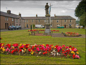
Newcastleton |
|
It was a pleasant ride along a flat
valley bottom with a river and steep sides. At one point I saw a
couple of large tents and associated vehicles making good use of the
flat grassy area by the river. I also noticed what looked like an
old railway viaduct crossing a side river. Further along I
approached a wooded area and came to a sign saying ‘England -
Northumberland’. Riding through open ground I could see to my right
the line of an abandoned railway track which I found puzzling in
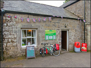
such a remote area. I saw a sign for Kielder, my next objective. It
pointed to a road off to the left which I took. There was a rut
across the road so deep it almost dislodged my front panniers. This
place obviously isn’t cycle friendly. A sign pointed to the village
shop. I rode to it and found it closed. |
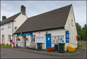
Closed shop in Kielder |
|
Continuing up the road I came to
Kielder Castle. An interesting looking building which I cycled round
then noticed the tea room at the front. Once again, a Saturday
morning and its closed. A cuppa would have been nice but not
available now even though the door was open. The map showed a toll
road running through the forest and up over Blakehope Nick to the
A68 road. |
Closed cafe at Kielder Castle |
|
Being a toll road there is a £3 charge
for cars but nothing else listed. I set off up the tarmac road which
says the other end is 12 miles away. It was fine at first then
degenerated to rough stone near a farm. After that it came back to
tarmac and all seemed well. The comfortable cycling soon ended
abruptly when I came to a loose rubble track. As I climbed higher
the track condition deteriorated. It may be OK on a mountain bike
with huge fat tyres and no load but a touring bike was not suitable. |

Blakehope Nick 1500ft 457m |
|
It was 6 miles of difficult ground to
get to the summit of Blakehope Nick at 457m and I can’t think of a
single redeeming feature of the track other than to be able to say
‘I’ve been to hell and survived’. The descent to a proper road was
another 6 miles of horror. The loose stones were like trying to
cycle through a deep mass of marbles. I managed to survive the
descent and so did the bike. Any cyclist seeking advice would do
well to take the longer way round by proper roads. It will probably
be quicker. The track seems to be a way for the Forestry people to
extract money from the unwary motorist. Perhaps a more sensible way
to make money would be to have a cafe that is open when people want
it. |
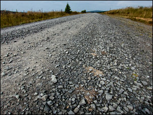
The horrible road over Blackehope Nick |
|
Thankfully I reached the A68 intact,
turned left and set off up the long steady climb to carter bar.
Before the main climb a building advertised ‘Welcome to the first
and last cafe in England’ But it was closed as well. The steady
climb to Carter Bar was easy and enjoyable. |
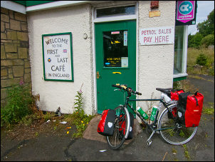
In spite of the signs its empty
and been closed for ages |
|
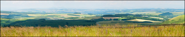
North view from Carter Bar |
|
A motorist even slowed down, the
passenger wound down the window and encouraged me on. The summit was
a reality check. It was swarming with tourists in the 2 large
lay-byes. A very bad piper was sort of playing the pipes but
annoyingly people were making donations to his begging tray. I hope
he uses the money for music lessons. |
Not much to say about this place! |
|
I was lucky that the weather had
cleared a bit and I had a wonderful panorama of the Scottish border
country in front of me. I started the descent to Jedburgh but the
first part was winding and fast and passing traffic weren’t prepared
to do it safely. Approaching Jedburgh I saw the sign to Ferniehirst
Castle. |
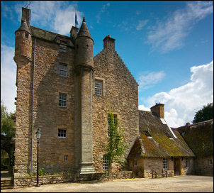
Ferniehirst Castle |
|
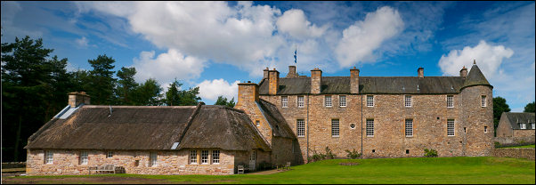
Ferniehirst Castle. It was a Youth Hostel from 1934 to 1984 |
|
The gate said closed to visitors but I
cycled up the track anyway as I wanted to visit it. In 1966 it was a
Youth Hostel and I stayed here when on a cycling tour of Scotland
with members of the Ribble Valley Cycling Club. It was now a very
impressive building and seemed to be privately owned. |
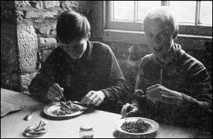
Inside Ferniehirst Castle in July 1966
when it was a Youth Hostel. Dave McKenna and Mal Fishwick tuck in to
Haggis and peas |
|
Nobody was about and it certainly
wasn’t a youth hostel anymore. I descended the steep access road and
continued to Jedburgh. I’d hoped to visit the old abbey but it was
£4.40 concession price to get in. I didn’t have time to do it
justice so cycled in to town to buy some water from the Coop. 4 lt.
cost me £1.10 which I thought reasonable. |
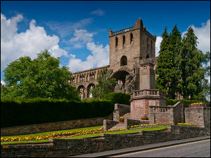
Jedburgh Abbey |
|
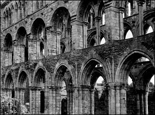
Jedburgh Abbey in July 1966 |
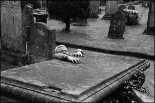
Jedburgh Abbey graveyard in 1966
Mal Fishwick comes back from the dead |
|
As I set off the
rain started. I found a bus shelter for a while until it seemed to
ease. I set off again and within a short time the rain began to
hammer down. I sheltered under some trees for 20min until it eased
then set off again. Within a mile it was torrential again so I
ducked in to the first bus shelter I came to. I waited a long time
for it to slacken off then headed off again through Ancrum. The rain
returned with a vengeance and I just had to find the first place I
could but a tent up. It was in a field after New Belses and gave
some privacy from the road. The rain battered down for the rest of
the evening. |
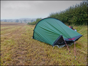
Camp 2 in a very wet field |
|
|