|
I woke to an unexpectedly clear and
starry sky. The view from the cliff top was astonishing with Jupiter
above Orion and Venus above the east horizon and ships lights
visible in the distance. The forecast was for rain later so I didn’t
hang around and left just after 7am in the hope of escaping a
soaking. |
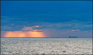
Morning view of the North Sea |
|
I called in to the local church to see
the last buttress of All Saints church before continuing through
woodland and rural lanes to Walberswick. It’s a pleasant but
isolated village and the sign at the entrance is not visitor
friendly by warning of parking restrictions at all times and hefty
parking charges. |

The last buttress of All Saint's
Church is preserved. |
|
It is separated from the larger
Southwold to the north by a river estuary. Both banks are full of
busy moorings and a rough cycle track runs inland a ways to connect
with a pedestrian bridge over the River Blyth. Once over a good then
bad cycle track goes to Southwold which was tidy but quiet as I rode
through which isn’t surprising as it’s a Sunday morning. The B1127
took me to Wrentham where I joined the main A12 road. |

Bridge over the River Blyth |
|
I always try and avoid such roads but
with no alternative I had to put up with the high speed traffic and
thoughtless drivers. Approaching Lowestoft I used a delightful cycle
route along the coast which took me right into the town centre. On
the way out I had a quick look at a bowling green which advertised
itself as the most easterly in England. A steep switchback road took
me back to Corton and Hopton-on-Sea. |

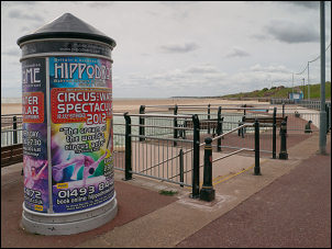
Lowestoft Seafront |
|
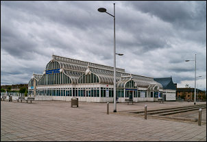
Lowestoft |

Maritime Museum by the Bowling Green |
|
Approaching Great Yarmouth |

Great Yarmouth moorings |
|

Haven Bridge, Great Yarmouth was opened by HRH the Prince of Wales
on the 21st October 1930.
The double bascule lifting bridge measures approximately 230 feet in
length, provides a navigation channel
of 88 feet in width. The 650 ton lifting arms are raised
electrically,
although can be operated manually in the event of a power failure. |
|
I had to rejoin the A12 for a while
before ducking back to the sea front and riding to the dock area. I
found an ‘Iceland’ shop where I bought a 5lt bottle of water for £1
then continued to Haven Bridge over the River Yare. There was a
definite joint in the middle indicating that it could be a lift
bridge but I couldn’t see any evidence to support this. Getting off
my bike and exploring both sides of the bridge didn’t give any
further clues. I now had water and was heading due west along the
A47 across Halvergate Marshes towards Norwich. |

At last I was off the A47 |
|
It’s definitely a road I would have
avoided if possible but I was stuck with it. The length I had to
ride was dead straight and about 7miles long. For such a busy and
major road it is relatively narrow making it even harder for me on a
bike. All I wanted to do was get this bit of the ride out of the way
and turn left on to less busy lanes. The only plus side of the ride
was a tail wind. Eventually the windmill came in to view that marked
the turn off, phew. Through Halvergate I took a very minor road
towards Hassingham where I’d seen a ruined church on the map. |
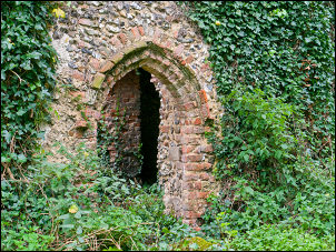
Church of St Edmund doorway |
|

Church of St Edmund doorway |

St Edmund gravestone |
|
My hope was that it would make a good
camp. I saw the square tower behind thick bushes and trees. There
was no entrance other than a gap in the hedge. I wheeled the bike
through to a wonderful open area of mown grass and the ivy covered
ruined church which looked Norman in construction. All that was left
were the walls and tower and some gravestones at the far end. It is
the Church of St Edmund and last used around 1870 when the
congregation merged with the nearby Limpenhoe. Most of the grassed
area was clear so I pitched my tent near the road behind a thick
hedge. The most recent gravestone I could find was 1832. A short
while after I got the tent up it started to rain. |
|

Church of St Edmund, last used in the 1870s |
|
|