|
Considering yesterday evening was
quite windy there wasn’t a breath of wind in the morning. The
downside was a lot of condensation in the tent meaning a soggy tent
to pack away. I was on my way by 07:45 and as the car park had a
rubbish bin I could get rid of my rubbish without having to carry it
far. The ride towards Esh Winning was easy and pleasant but I was
riding due east and straight into the rising sun causing a lot of
dazzle. Being a Sunday morning there wasn’t much traffic and it
didn’t seem very long before I was entering Durham. |
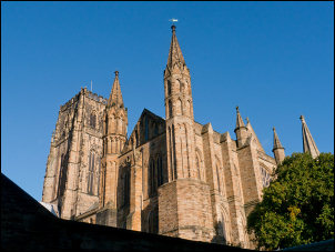
Durham Cathedral |
|
Instead of following the road into the
town I’d planned a route along an old road that is now closed to
traffic. It was too rough to ride on so I wheeled the bike down to
the bridge. The bridge was wide and impressive in the morning light.
A few runners were out and some rowers on the river. I spoke to a
lady taking pictures and she turned out to be a local artist, taking
pictures to inspire her next work of art. We walked up and old lane
into the town then she left to explore another way. |
|
I continued along my planned route but
made a short detour to look at the Cathedral. Durham Cathedral is
one of the oldest truly Norman Cathedrals dating back to 995AD. The
main entrance was on the shaded side so not good for pictures. I
went inside but as soon as I got my camera out was told quite
sternly that photography wasn’t allowed. The reason, I was told, is
that it is intrusive. I walked to a secluded and deserted part of
the cathedral and ignored the instructions and took a photo. I
returned to the main cathedral and hoped to sneak a picture but was
spotted by another man who reiterated the no photography rule. We
had am amiable chat and eventually he let me take a few quick
pictures before I left to continue on my way. It turned out the
originator of the no photography rule was the Bishop of Durham, who
is a keen, and allegedly, good photographer. There seems to be an
ethical dilemma here. |

Durham Cathedral nave |
|
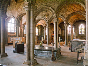
Durham Cathedral interior |
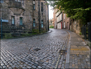
Durham street |
|
I was back on the main roads for a
while then headed through a large housing estate to more quiet
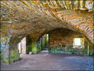
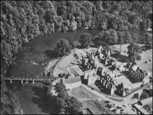
roads. My next objective of the day was Finchale Priory. A steep
hill took me down to the priory ruin which looked impressive in the
sunshine. There didn’t seem to be an entry charge, except £3 for the
car park. The cafe was open so I ordered a £2 chip butty to be ready
for when I returned from my tour of the ruins. The ruins were
excellent as was the chip butty. |
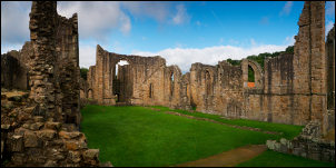
Finchale Priory |
|
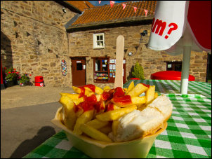
Finchale Priory butty |
Finchale Priory |
|
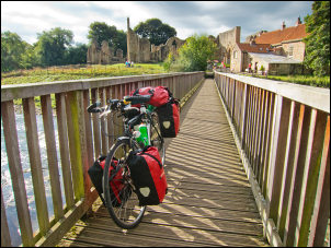
I spoke to a man who was there with
his daughter. He asked where I was heading and I told him my next
call was the Tyne cycle tunnel. He said he thought it was closed.
I wheeled my bike across the wooden footbridge and a short way along
the path on the far bank. |
Finchale Priory |
|
A cinder track continued along the
riverbank but steep stone steps headed up the route I was on. They
were far to steep to push the bike up loaded so I had to take all
the panniers off and make two trips up the steps. It seemed to take
ages and once at the top I think there was a better cycle route up
via the cinder track. |
Bridge over the River Wear |
|
I followed the road to
Chester-le-Street which didn’t have anything making me want to stop.
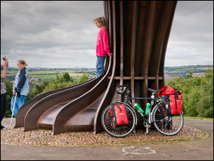
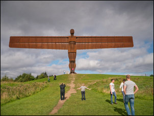
I continued north to Gateshead and the incredible art structure by
Anthony Gorman called Angel of the North. I’d never seen it live
before and was amazed at it size, location and beauty. Many people
were there visiting it and it must be one of the most photographed
works of art anywhere. |
Glascarnoch River and the old bridge |
|
Angel of the North |

Angel of the North |
|
I'd previously |
|
|
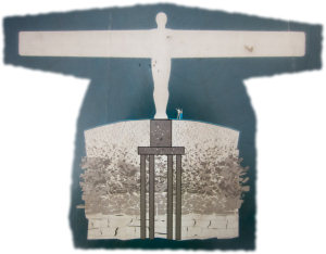
Angel of the North, what's underground |

Scene from old Jarrow |
|
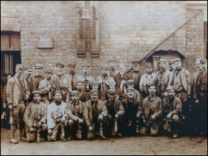
Scene from old Jarrow |
|
I continued north then east to Jarrow
and the pedestrian & cycle tunnel under the Tyne. I reached the site
which I’d visited last year to find the man at the monastery was
right. It was closed for refurbishment. I checked the map which
showed a diversion to find a bridge would be over 10 miles. Nearby
was a bench where a group of men were enjoying an early afternoon
session of bottled beer and cheap cider. |
Closed Tyne cycle tunnel |
|
I asked them how far to the nearest
bridge and they pointed to a bus stop across the road where a free
service would take me across the river. I had a 20min wait which was
preferable to the long detour. The bus arrived with a trailer loaded
with bikes. |
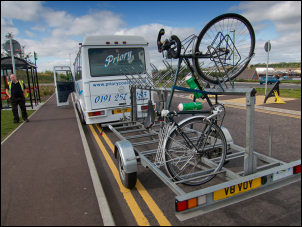
Bike trailer |
|
The cheery driver strapped my bike on
the trailer. My panniers were stowed inside the bus and we made the
short trip under the road tunnel to the north bank of the river. |

Driving under the Tyne |
|
My journey continued through Whitley
bay and up along the coast. |
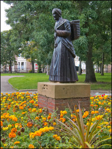
No sign to say who this is. |
|
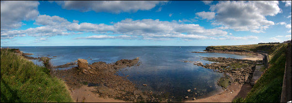
Wide view at Seaton Sluice |
|
My planned camp for the night was on
the bank of the River Blyth on the far side of Blyth. I reached the
outskirts of Blyth to also reached a conundrum. Would the first shop
selling water be the best or should I hang on to hope a large chain
store had a branch in the town. I went for the ‘get it while you
can’ option and bought 2, 2lt bottles of water for £1.89 each. As I
cycled through the town I saw a branch of Morrisons and also Tesco
selling water at 20% of the price I’d paid. I reached the signposted
cycle track along the River Blyth. It was tarmac and excellent
cycling. I needed to look for a pitch and found a grassy area which
looked above high water of the still tidal river. Two boys were on
the muddy river bank and one was fishing. I asked them if the tide
was rising. The nearest boy answered in a wonderful broad Geordie
accent which I’d never heard before. The tide was rising so I chose
the highest point I could. I was glad I did because the water
eventually came to within 1m of where I was. |

Camp by the River Blyth |
|
|