|
Overnight rain had stopped by morning
so the tent wasn’t too wet as I packed it away. It wasn’t properly
light as I set off so my bike lights were needed in the dark valley.
It’s a very quiet road and I only heard 2 or 3 vehicles the whole
time I was camped overnight. The road soon started to climb steadily
then steeply. The climb was about 3 miles and one stretch was too
steep to ride and I had to push the bike. After a false summit the
climb started again and just over the highest point I descended into
Wanlockhead. It was originally an old lead mining village. There
were plenty of houses but no people about. The road out of the
village was a steep climb back to the main road then a long descent
to the village of Leadhills and more remains of old lead workings. I
continued on the B797 to Abington. By now the rain had started again
and I had to ride in full waterproofs. The approach to Abington was
easy to recognise because of traffic noise on the busy M74 which
winds through the valley. Passing the busy Abington Services I
headed out on the busy A702 to Biggar. |
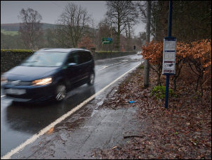
A brief stop near Coulter to shelter from the rain. |
|
I was apprehensive about taking this
busy route but didn’t have much choice. It turned out to be not as
bad as I’d thought. The road undulated but no steep climbs. Riding
in to Biggar was similar to Moffat as the centre street layout and
houses are almost the same. I left the town and turned right to head
east along the B7016. I had a quick look at the Puppet Theatre
building but it was closed, even though I was within the opening
hours shown on the sign. This is where the rain and low cloud were
annoying because they obscured the picturesque hills around. I
passed the sign saying I’d officially entered the Scottish Borders. |

Officially entering the Scottish Borders |
|
At Broughton I turned right for a
couple of miles on the main A701 then left on to the minor B712. The
rain continued to fall and I had to ride on to Stobo before I found
a bus stop shelter where I could stop for something to eat and
drink. I carried on in to Peebles where I made a detour to have a
look at the old church ruin. It was annoying that I couldn’t take
any decent pictures because of the rain as I didn’t want to get my
camera wet. |
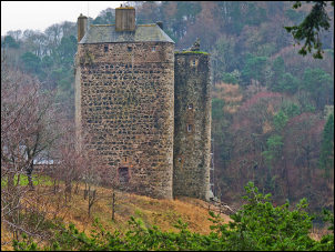
The late 14th century Neidpath Castle
on the approach to Peebles. |
|
The church ruin, the Peebles Cross
Kirk was built in the 1260s and in 1474 became a religious house for
Trinitarian friars. After the Protestant Reformation in 1560 the
friary became a parish church. In the 1780s the roof was removed and
the ruin used for burials. |
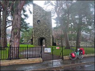
Peebles Cross Kirk |
|
I left Peebles to the east on the A72.
I hadn’t been going long when I noticed a cycle path sign by the
road. I though it would be good to get away from the traffic for a
while so I followed it. It soon descended into a tunnel under the
road so I stopped at the far end to investigate. It was an old
railway tunnel and the route was following the old railway. The
tunnel gave me a brief rest from the constant rain. |

The tunnel gave me a brief rest
from the constant rain. |
|
Riding along the route was a delight,
in spite of the rain. At one point there was a shiny new bridge over
the river Tweed. It was also a bridleway and horse riders were
advised to dismount. Wooden step platforms were provided at both
sides of the bridge. |
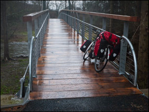
Shiny new bridge |
|
The trail ran all the way to
Innerleithen where I called in at the Co-op for 2*2lt bottles of
water £1.09. I continued east along the A72 but before leaving the
town turned right to follow another sign posted cycle trail. It
continued for a mile or so, crossed the river, then joined a minor
road on the south side of the river. This is the road I’d planned to
follow so continued a few more miles to find a camp spot in trees to
the right. It had been a 55mile ride in rain most of the way. |

Old Railway bridge over the River Tweed
is now a cycle path |
|
|