|
The rain stopped overnight but the
morning was overcast and dull. The wind had dropped so I was plagued
with midges as I packed up the tent. I was on the road by 7am and
rode on for a few miles to pass my original planned camping spot. It
didn’t look too good so I’d made the right decision to stop where I
did last night. |
|
|
In the distance I could see Portree
and for about a mile I had and easy downhill ride into the town.
Through the town I continued south on the A87 and up the steady
climb through Glen Varragill. The area has large swathes of cut down
pine forest which look very unsightly and not a good advertisement
for forestry work. At the south end of the glen I reached the road
junction with a large camping area to the left and the start of the
Loch Sligachan. |
|
|
|
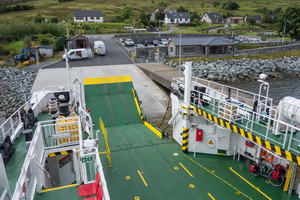
The
ferry leaving Sconser for Raasay |
|
|
The road climbed above the south shore
and I didn’t have many miles to ride to reach Sconser and the Raasay
ferry. The time was just before 9am and I was in good time for the
09:25 sailing across to Raasay. There were many people already
waiting but the majority were part of an organised group. I waited
at the right side of the slipway until the ferry came then wheeled
my bike on board for the £6.45 return journey. Mine was the only
bike. The Raasay ferry landing point shown on my map is completely
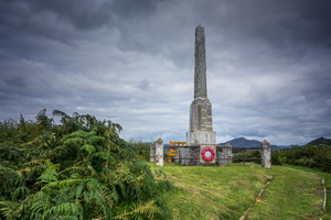
wrong. We landed at Clachan /Churchton Bay. I cycled into Inverarish
and along to the war memorial. |
|
|
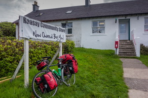
Then I visited the village shop and
asked if Calum, of road building fame, was buried on the island. The
young lady didn’t know. She asked another lady working in the shop
and said she thought he was. She had a northern English accent.
Fortunately one of the locals was in the shop and she confirmed he
was in the new area of the cemetery. |
|
Men of iron.
Raasay was a centre of heavy industry between 1916 and 1919. Huge
quantities of iron ore were extracted, processed and shipped to
smelters in southern Scotland. Many of the workers were German
prisoners of war. The industry collapsed in the 1920s when the iron
ore price crashed. |
|
|
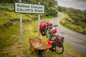
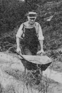
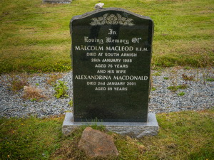
My next objective was to ride to
Calum’s Road to the north. I’d try and find his grave on my return.
Calum was Malcolm MacLeod (1911- 1988) of Arnish, Raasay. After
trying to get the authorities to build the last length of road to
his village, without success, he did it himself. His task began
around 1960 and took over 10 years. |
|
|
|
|
|
|
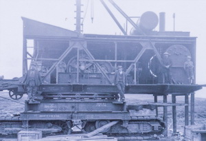
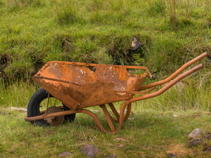
I don't
know if this is one of
Calum's wheelbarrows. Hope so. |
|
|
I took the high road climbing steeply
up through the trees to the Scottish Youth Hostel which is on open
ground. The single track road climbs high along the spine of the
island and is a difficult succession of steep climbs and descents.
The final descent was long and very steep in places. I reached the
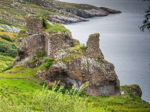
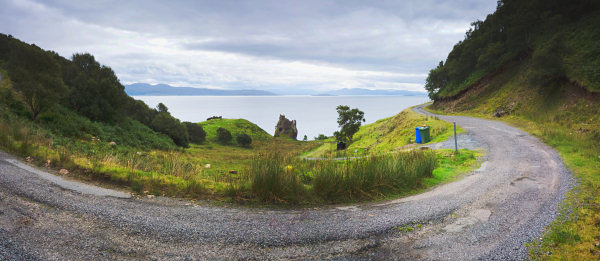
magnificent ruin of Brochel Castle perched precariously on a clif
top almost overhanging the sea. There is a small car park here and a
sign denoting the start of Calum’s road. By the sign is a rusty old
wheelbarrow and it would be nice to think it was the one Calum used
to build his road, though I doubt it.
Some notes on
Calum's Shed here: |
|
|
|
|
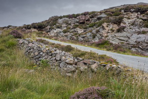
South
end of Calum's Road looking across to Applecross |
|
|
I started to follow it but the first
part was too steep for my loaded bike so I had to push. At the top
of the first rise was a memorial cairn to his achievement. His road
is less than 2 miles in length but considering it was just him and a
wheelbarrow I find it the most amazing achievement. The final
descent is steep and a cliff top stretch above the sea below is
almost unbelievable. |
|
|
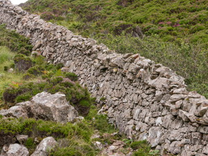
At one inlet was the infamous deer
wall that crosses the narrow point of the island to keep the people
and their livestock off the landowner’s hunting ground. It was built
by George Rainy is the 1860s using local labour. |
|
|
|
The
infamous George Rainy wall c1860s |
|
|
The end of the road is rather an
anticlimax. All there is is a Private and No entry sign. With thick
undergrowth and trees everywhere I couldn’t see anything of village
life that once thrived here. There are a few private houses but
nobody about except for the few tourists. My return was as tough as
I’d feared, having to push my bike up some incredibly steep
roads.Back at the castle I knew I had a lot more hard work to come.
I paced myself and eventually reached the highest point on the road
with a good view of Portree across the sea. I thought it would be a
good place to camp so put the tent up and found water from a stream.
Unbelievably there wasn’t a breath of wind. |
|
|
I’d relied on a good breeze to keep
the midges away but I was plagued with them. The hat with insect
mesh helped but couldn’t keep them all out. I had no choice but to
hastily pack up and set of down. I used the low road this time via
Oskaig then after the ferry turn off turned left up the step track
to the cemetery. There I found Calum’s grave where he was buried in
1988 and was later joined by his wife who died in 2001. On the top
of the headstone someone had placed a small stone, presumably taken
from his road. I rode back to the ferry waiting room and noticed a
rough piece of grassland over the wall & by the shore. I didn’t
think anyone could object to me camping there so wheeled my bike
round to pitch my tent. The waiting room toilet sink was ideal for a
water supply. |
|
|
In Loving Memory of:
Malcolm MacLeod B.E.M.
Died at South Arnish
26th Janualry 1988
aged 76 years
and his wife
Alexandrina MacDonald
Died 2nd January 2001
aged 89 years |
|
|
|