|
Thankfully the rain had stopped by
morning and even though the sky wasn’t clear it was fine enough. I
was eager to get going so was packed away and on the road just after
06:30am. I continued along the single track road along the south
shore of Loch Eil. |
|
|
|
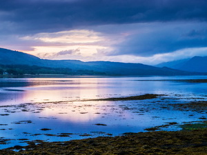
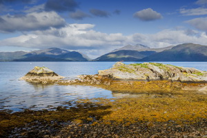
Morning
view of Loch Eil from the tent |
|
|
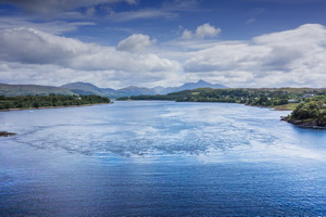
The ride was mostly flat and easy and
with most of the first part through trees there was little wind.
Eventually I turned to the SW as Fort William came in to view across
the loch. By a collection of small houses was a small jetty and a
sign saying cyclists wanting a ferry to Fort William to phone a
mobile number. I continued. The ride was pleasant and extra nice
because I didn’t need cumbersome waterproofs. After 17 or 18 miles
the distant Corran ferry boat came into view. |
|
|
|
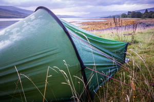
Camp
after 36 hours of rain |
|
|
I still had a few miles to cover to
reach it and hoped it wouldn’t reach my side and depart before I got
there. They run every 20mins during weekdays so it didn’t really
matter. I reached the ferry terminal just as the ferry did so after
the cars drove off I pushed my bike on before the cars were allowed
on, which made a pleasant change. |
|
|
|
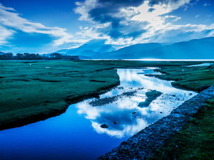
Inverscaddle Bay towards
Ben Nevis (in cloud) |
|
|
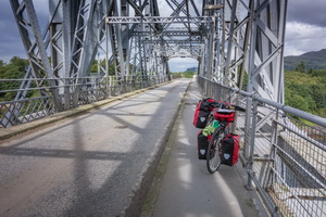
It’s not run by Calmac and pedestrians
and cycles travel free which is also a pleasant change. On the other
side I joined the busy A82 and turned right to head south towards
the Ballachulish Bridge. The road is quite narrow for the volume of
large vehicles using it and wherever possible I rode on the
footpaths. The main hazard was the rubbish bins people had put on
the paths and at times I had to return to the road. Once over the
Ballachulish Bridge I joined the A828 to Oban and started with the
intention of finding the cycle path wherever it existed. |
|
|
A lot of the old abandoned railway has
been converted to a track but signage is woefully inadequate. I’d
been on the road a few miles when the road passed a bridge over the
old railway. I looked down to see a cycle track below but no idea
how to get on it. Riding further on I found a lay-bye and rough
track connecting to the cycle track. |
|
|
|
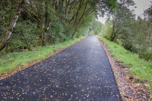
View
from the railway cycle track |
|
|
I took it. It was an enjoyable ride
but didn’t last too long. At Kentallan I emerged onto the road and
saw another sign pointing to place I hadn’t heard of, certainly no
mention of Oban. I tried it and it turned out to be a brand new
track by-passing the road and emerging onto the old railway. I
managed to keep away from the road for while before having to rejoin
it again. |
|
|
|
The old
Kentallen Rail Station |
|
|
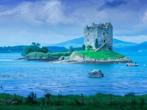
I was glad to reach the cycle track
that took me to Appin and the old railway platform with amazing view
if the Castle Stalker Appin. Here I met some cyclists heading north
towards John-o-Groats. They’d pre booked accommodation and on their
way to For Augustus. |
|
|
|
The old
rail track is now a cycle track |
|
|
|
|
|
I continued along the excellent cycle
track which later on went through dark woodland then emerged back on
to the road again. This ‘on off’ continued all the way to Oban
Airport and the Connell Bridge. Here I was back on the road for a
while before taking to the footpath all the way back to Oban. I
reached the car about 12:45. The day’s stage had been 56miles. I put
the bike into the car then drove back the way I’d cycled to
Ballachulish then on to Fort William and Culnacraig to do some
walking. |
|
|
|