|
It was a very clear night and bright
with stars. The temperature dropped considerably and was just under
-1degC. I was on my way by 7:20am and as I descended to the head of
the Nick the morning sun was striking the far walls of rock.
Crossing the beck the shallow areas were still covered in ice. I
headed for the far side of the valley and took a direct line up to
reach the edge of the high fell. I knew that if I continued directly
over the top via Little Rundale Tarn the going would be very
difficult. So I turned left and kept to a slightly lower green path
which kept me to the edge of the fell and a much easier route. I
also kept the nice views. I also wanted to check out the trig point
to the west of Seamore Tarn and this way I’d be able to reach it
without a detour. I passed a few large cairns or curricks as they
are called in this area. |
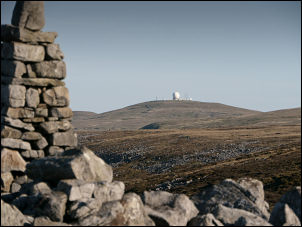
Great Dun fell from the trig point near Seamore Tarn |
|
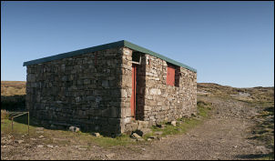
Hut near Great Rundale Tarn |
I saw the trig point ahead and found
it to be of rough stone construction with the face plate missing.
The top plate was still intact. A faint path took me to a higher
cairn then another path headed for the shooting hut near Great
Rundale Tarn but the path soon vanished and I had to make my way
across rough ground before reaching the main track and a short walk
to the hut. I’ve visited it before and as with the last time it
wasn’t locked and was clean inside with a large table and a couple
of long benches to sit on. I had a short rest and continued up the
fell to the NW. It was rough at first then the going improved as I
approached Green Fell, The Heights and another version of the
Pennine Way. |
|
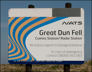
The summit of Great Dun Fell. This is
the radar station that is operated by NATS (National Air Traffic
Services Ltd) and is a key part of the Air Traffic Control system
for Northern England and Southern Scotland. |
 |
|

Great Dun Fell radar station |

Great Dun Fell radar station |
|
Straight ahead was the distinctive
dome of Great Dun Fell radar station. Stretches of the path were now
paved with imported slabs of stone and probably some of the lowest
quality work I’ve seen. It seemed fairly recent and there was no
attempt to set the stones properly. They rocked and wobbled and in a
few years will be covered in slime making them treacherous to
descend and people will have to revert to the heather at the side. I
descended to the saddle then joined the vehicle access road up to
Great Dun Fell. I saw a walker descending and we stopped briefly to
chat. He was doing the Pennine Way as a charity walk. He’d spent
last night in Greg’s Hut and was heading for a camp at Cauldron
Snout in Teesdale. He was also doing it unsupported and had all his
supplies with him. I can’t imagine how difficult it would be to plan
and carry everything for such a long trip. We said goodbye and left
in opposite directions. I reached the summit and took a few snaps of
the radar station then walked round the fencing to head for Little
Dun Fell. More wobbly stone slabs had been badly laid along the
route. The summit has a small cairn on it then it is generally
downhill, through an area of boulders and down to the wonderfully
named Crowdundle Head. To the right is Tees Head so presumably this
is the source of the River Tees. Earlier I’d seen a couple of people
in the distance and assumed they were walkers. They didn’t seem to
be doing much but as I got closer I could see they were working on a
fence. It appeared to be an electrified fence judging by the small
notices fixed to the top of the posts. |
|

Telephoto view of Great Dun Fell from
Cross Fell |
|
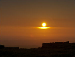
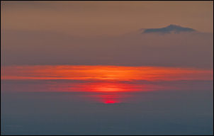
Sunset from the tent door |
The huge SE face of Cross Fell was up
ahead and I followed the path and more badly laid slabs, up towards
the summit. It’s a steady climb and not too steep. Just before a
final band of boulders is the source of a spring of clear water. The
strange thing is that it’s not shown on the map. Up through the
boulders I was on the Cross Fell plateau. Even with clear blue sky
and sunshine there was a severe and cold easterly wind. It’s
deceptively large and the summit trig point was still a way off. I
passed it and the adjacent stone windbreak and continued over to
locate Crossfell Well spring which is where I’d planned to get my
water for today’s camp. Its many years since I’d seen the well and
had in mind it was near the summit. |
|
I reached the edge and looked down to
see a stream far below. My heart sank momentarily as I thought I’d
have to climb down then back up again. Fortunately the main spring
was just below me in the rocks. With a god supply of water I set off
again across the plateau to the west. I found a nice grassy spot
close to the edge. It was handy that I could get all the pegs
securely in as the wind was very strong and getting stronger. The
sunset was at 20:30ish and I watched an interesting mix of
cloudscapes changing shape as the sun vanished. |
Sunset and changing clouds |
|
|