|
Wed 20 Jul 2011
A fairly quiet night with no rain. It was still overcast and gloomy
at first light. I tried a few photos of the lighthouse from the tent
while the light was being used. Today's plan is to get close to
Tarbert ad catch the Skye ferry in the morning. I left the camp and
had a look at the harbour at Port Nis before returning along the
road to Barvas. This time the wind was mostly in my favour but had
died down a lot since yesterday. |
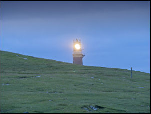
early morning view of the Butt of Lewis lighthouse |
|
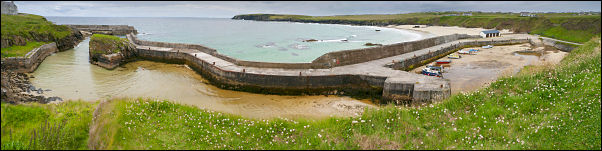
wide view of the harbour at Port Ness |
|
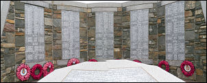
one of several similar War memorials |
I stopped to look at a couple of war
memorials on the way and both seemed almost identical and fairly
recent. I didn't want to return along the same route as yesterday as
there is an alternative way that looks a bit longer but more
interesting. |
|
The map showed a settlement that seemed large enough to
have a shop about 8miles along the road. There were plenty of houses
but not a single shop. Many houses were empty and ruinous and only a
minority were in good condition and well looked after. Most of the
houses both lived in and empty had rusting cars in various states of
decay. However, churches were plentiful, mostly large and well
maintained. I stopped to watch a group of men and one woman shearing sheep by the
road. Their shears and equipment was powered by a generator in a
van. The terrain and roads were good and I was glad I'd made the
decision to come this way and not the unbelievably bleak road to Stornoway. |
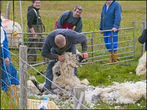
sheep shearing |
|

the Standing Stones of Calanais |
|
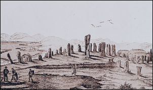
old illustration of the Standing Stones |
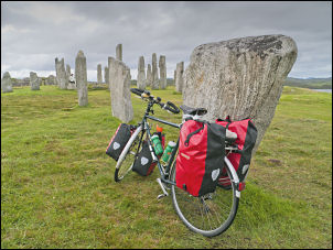
the stones were a handy place to prop my bike |
|
An unexpected treat was seeing the Standing Stones of Calanais in
the distance. There was a fancy visitor Centre but the actual stones
are free access. I even wheeled my bike in to photograph it by the
stones.
I was on the A858 and B8011 branch I continued on along a mostly
deserted stretch of road. After 8miles I reached the A859 which is
the road I was on yesterday. I turned right to head for Tarbert.
Again, the wind was generally in my favour and the ride was very
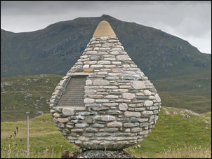
enjoyable. I spotted an interesting stone globe just off the road.
I'd missed it while passing yesterday. I stopped to investigate and
found it marked where Bonnie Prince Charlie landed in May 1746 while
on the run after the defeat at Culloden. As I rode on I was
wondering how the steep climb would be to the pass over to Tarbert.
I saw it in the distance and saw Lorries labouring upwards. When I
got there I put the bike in bottom gear and taking it steady had no
problems at all. At about the highest point there was a small side
road which was part of the original road. I thought this would be a
good place to camp as it is only about 4 miles from Tarbert. There
was a good stream for water and even a mobile phone signal. Traffic
noise was the only downside.
70.55 miles today. |
|
At this
spot Bonnie Prince Charlie landed on 4th May 1746 while on
the run after having sailed from Scalplay. It was 18 days
after the disastrous Battle of Culloden where he was
defeated by the army commanded by William, Duke of
Cumberland. |
|
|
|
|
|