Boyd's photo diary. |
|
|
|
|
|
|
|
Sat 30 Jan 2016
|
Thu 28 Jan 2016
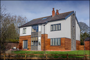
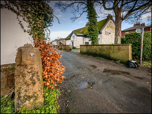
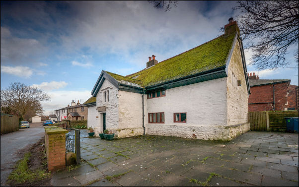
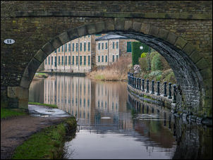
The building on the right is Navigation House. Many years
ago it was the Navigation Inn on the bank of the Lancaster
Canal. The canal was filled in around 1967.
The two photos
below are the adjacent house. The left is how it used to look
and on the right is after recent cladding and alterations. |
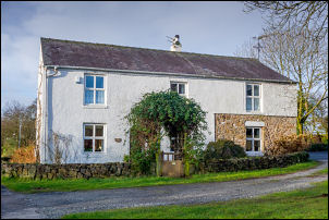
Navigation House |

Google
view |
This morning |
|
Wed 27 Jan 2016
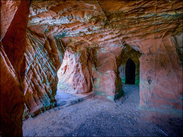
I enjoyed a wet and muddy walk along the River Eden, Cumbria.
North of Little Salkeld are the amazing Lacy’s Caves. They are
carved into a sandstone cliff and were commissioned by
Lieutenant Colonel Samuel Lacy of Salkeld Hall in the 18th
century. The caves were used by Colonel Lacy as a romantic folly
for entertaining his guests and the area was originally planted
with ornamental gardens. |
 |
|
|
Mon 25 Jan 2016
|
|
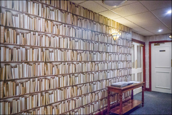
This evening I gave an illustrated talk about Nepal to a group
at the Mercure Foxfields Hotel near Whalley. One of the
corridors had bookcase wallpaper along one side. I found it
quite disturbing.
|
|
Sat 23 Jan 2016
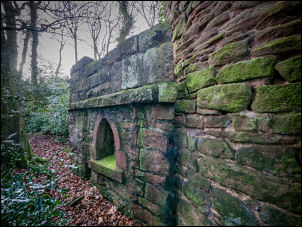
The Brindle & Hoghton history pages on Facebook are run by
local historian Steve Williams.
On Thu 21 & Fri 22 Jan 2016
he posted some fascinating old pictures of the Folly in the
grounds of Brindle Lodge, off the Blackburn Preston Road,
Hoghton Lane A675.
It is know locally as the "Voodoo Tower" |
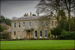
Brindle lodge |
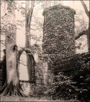
Old
photo of the Folly |
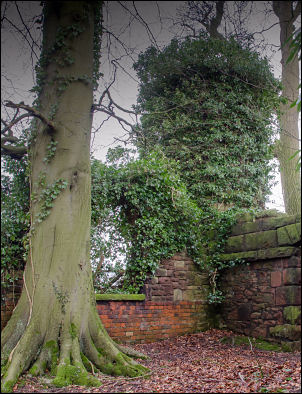
The Folly today |
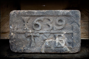
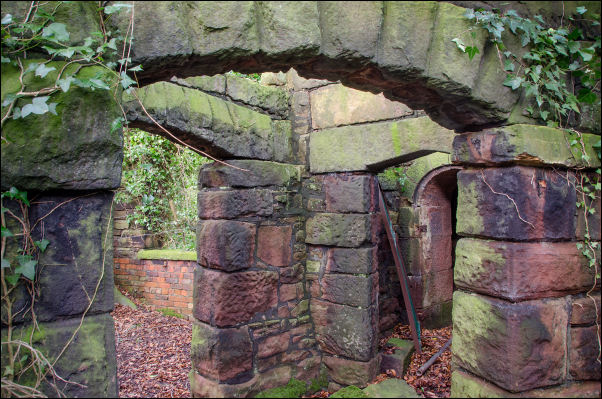
The structure is grade 2 listed and the description is:
Folly
in Grounds of Brindle Lodge Grade: II English Heritage Building
ID: 184294
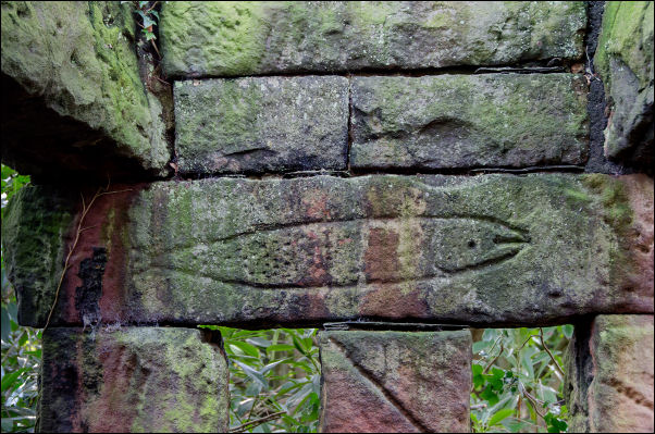
The listing text says:
Folly, probably early to
mid C19. Red brick, red sandstone random rubble, and gritstone.
Small circular tower, c.5 metres high, of random rubble, and
attached at the base a small roofless enclosure of loosely
Gothic intention, with 2 archways, a pointed arched window, and
some ex situ fragments including a large rectangular stone with
a fish carved on it, and a date stone inscribed 1639. Item is
close to Preston to Blackburn railway, and may have been built
in some relationship to it. |
|
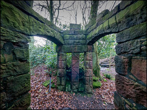
The structure is in the private
grounds of Brindle Lodge and there is no public access to it.
The following information and photographs are intended to give
all the information that I obtained from my authorised visit so
there is no need to try and make an unauthorised entry.
Comments on Facebook mentioned children gaining access many
years ago by sneaking in by various routes. There are some
public footpaths with lovely views around the area and I
recently saw a local farmer who told me about the folly and how
children would gain access via a bridge over the nearby railway.
The bridge has now gone. |
 |
 |
 |
 |
|
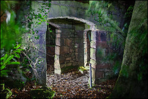
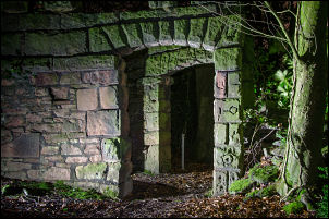
I thought the only way to investigate further was to visit
Brindle Lodge and ask permission from the owner. The first time
I called he wasn’t in but on Sat 23 Jan he was. He was very
helpful and said it was OK to photograph the folly. To get there
we had to go through a gate in a high wall and across his
private garden area. The folly was still the same as shown on
the old photos except the tower, which is now covered in ivy. |
 |
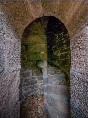
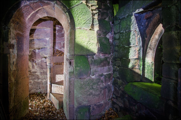
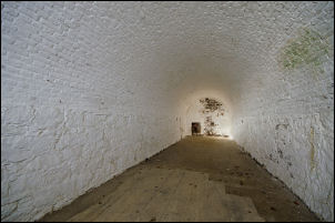
The Tower staircase |
 |
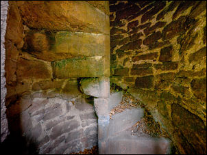 |
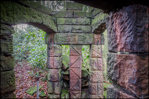
The main structure is a circular tower about 5 metres high with
a spiral stone staircase going up the centre. It is of random
stone and the oldest part of the structure, though it is not
possible to say how old. The adjacent Brindle Lodge is said to
date from 1809 and the tower could be from then or older.
Yates’ Map of 1786 doesn’t show it. The 6in to one mile Ordnance
Survey map of 1848 shows it as just a tower. The 1892 1/2500 O.S.
map shows the tower and adjacent Gothic walls attached. The
walls, arches and window frames are of dressed stone with random
infill and appear to be from various locations. They are not
keyed in to the tower so were probably added later. The listing
description mentions a date stone of 1639 which has been removed
from the structure by the owner for safekeeping. The stone will
have been reclaimed from elsewhere and does not date the
structure.
The adjacent Brindle Lodge is also a grade 2
listed building and has a better documented history. I believe
Steve will be investigating more details about it and adding
them to the Brindle and Hoghton Facebook pages. |
|
Fri 22 Jan 2016
Late morning drove to Gregson Lane, parked by the village
hall and went for a walk via Gregson Lane and Brindle Lodge
area. On the way I passed Arrowsmith House which has quite a
history. It is a grade 2 listed building, English heritage ID:
358030. A date stone on the porch says 1700 but it is much
older. |
 |
| It
is linked with the death of
Saint Edmund Arrowsmith (1585 – 1628). He was one of many
persecuted Jesuit Priests in Lancashire. A plaque over the door
states that he offered mass in Arrowsmith House and made his
escape to ‘The Moss’ near Sandy Lane where he was captured. He
was taken to Lancaster Castle where on August 28th 1628 he was
hanged, drawn and quartered. |
Arrowsmith House
|
|
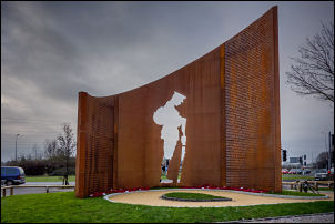
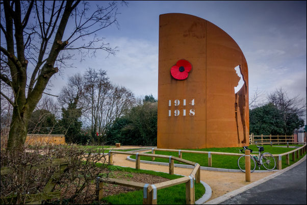
Thu 21 Jan 2016
Had a morning cycle ride via Lostock Hall to look at the new
War Memorial by the Stanifield Lane roundabout. |
 |
|
|
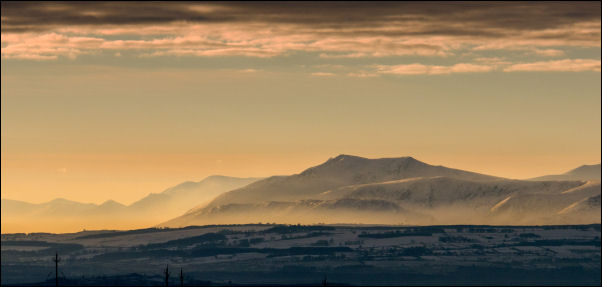
Wed 20 Jan 2016
|
|
While driving home from a snowy walk in Teesdale I saw this
spectacular view of Blencathra and the Cumbrian fells from
Hartside Pass.
|
|
Tue 19 Jan 2016

|
|
Bike ride via Croston and Leyland. Saw impressive new greenhouse
being built on Holker Lane, Ulnes Walton.
|
|
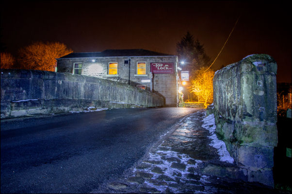
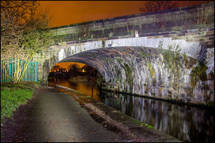
Sun 17 Jan 2016
|
|
A Sunday evening walk along the Leeds and Liverpool Canal at the
Top Lock, Copthurst Lane. The Top Lock Pub is in Wheelton but
the canal bridge is in Whittle-le-Woods.
I remember when it
was called The Anchor.
|
|
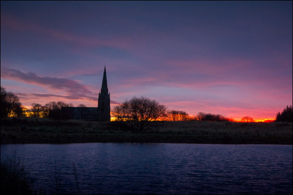
Sat 16 Jan 2016
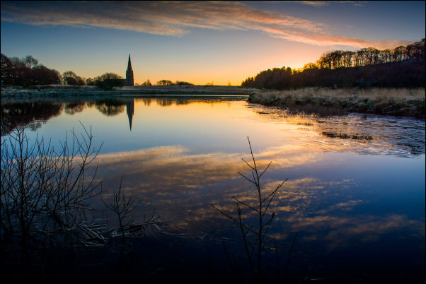
Chilly morning view of St Peter's
Church Belmont across the Blue Lagoon
|
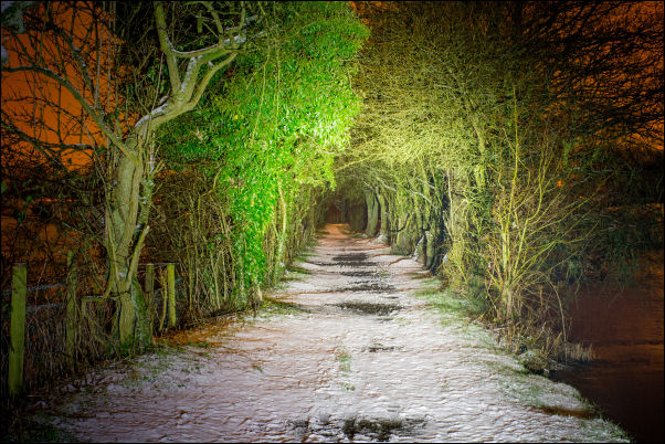
Taken on my evening walk along the
Lancaster Canal
towards Town Lane, Whittle-le-Woods
(this
photo was shown on the BBC TV Breakfast programme
on Sun 17
Jan 2016)
|
|
Fri 15 Jan 2016
|
Walked from Askham over to Pooley
Bridge to see the site of the washed away bridge. It was one of
the casualties of the December 2015 floods.
|
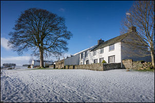
Askham in the snow |
|

|
 |

All that's left of Pooley Bridge
|
|
Wed 13 Jan 2016
|
Set off from Dunmail Raise and walked
over Dollywagon Pike to Hevlellyn summit in the snow. Descended
to Withburn to look at the Dec 2015 flood damage to the A591
road.
|
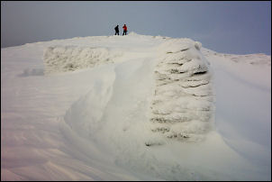
Helvellyn shelter stones |
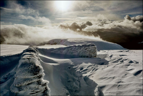
Helvellyn shelter stones. The
temperature was -6decC
|
|

|
 |
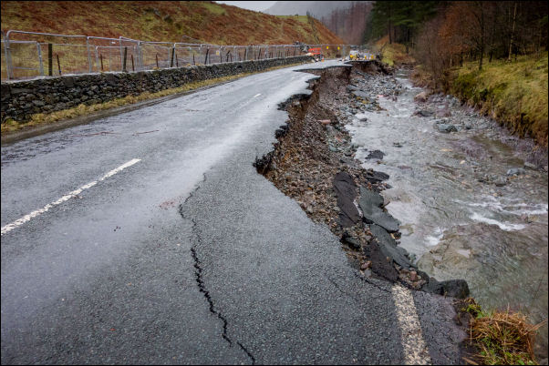
The A591 where it has been washed away
by the floods
|
|
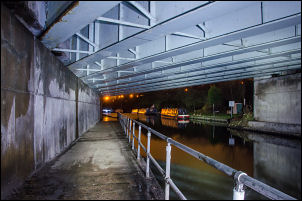
Tue 12 Jan 2016
|
Drove to Todmorden to catch the 09:50
train to Rochdale. Walked back along the Rochdale Canal to
Littleborough then caught the train back to Todmorden.
|
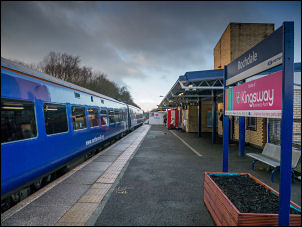
Rochdale Railway Station |
|

|
 |
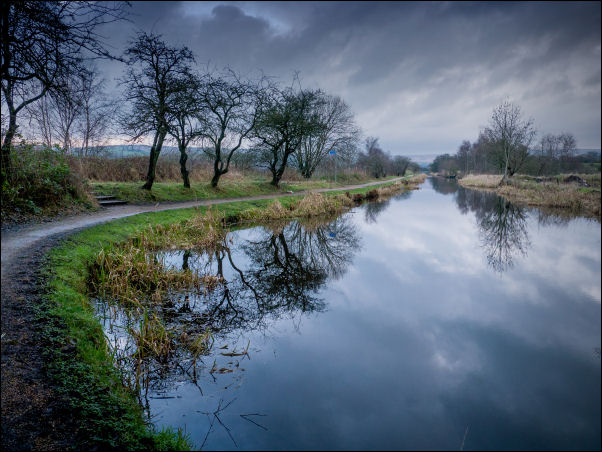
Rochdale Canal
|
|
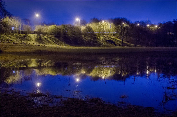
Mon 11 Jan 2016
|
| This morning’s
view across the flooded field between Kem Mill Lane and the
River Lostock. The Lights of the Preston Road (A6) are reflected
in the flood. |
|
Sun 10 Jan 2016
|
Drove to Blair Atholl and parked in car park on the approach to
St Bride’s Kirk. It was still dark when I arrived so waited for
light before walking to the ruins of St Bride’s. Within the
vault beneath are interred the remains of John Graham of
Claverhouse, Viscount Dundee. Who fell at the Battle of
Killiecrankie 27 July 1689, aged 46. (John Graham of Claverhouse
was also known as 'Bonnie Dundee')
|
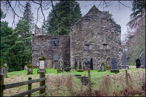 |
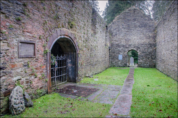
St Bride’s Kirk
|
|
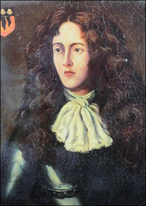
John Graham of Claverhouse was also known as 'Bonnie Dundee'
|
 |
|
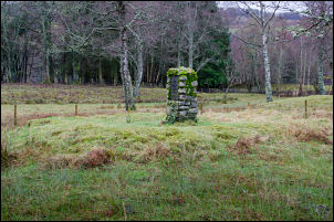
Then drove to the site of the Battle of Killiecrankie and walked
across the wet field to the stone memorial pillar that marks the
battle location.
It reads:
In Memoriam. The Battle of
Killiecrankie. 27 July 1689. The cairn marks the grave of the
officers of both sides and honours all who on that day died on
their duty and as became true men of valour and conscience.
|
 |
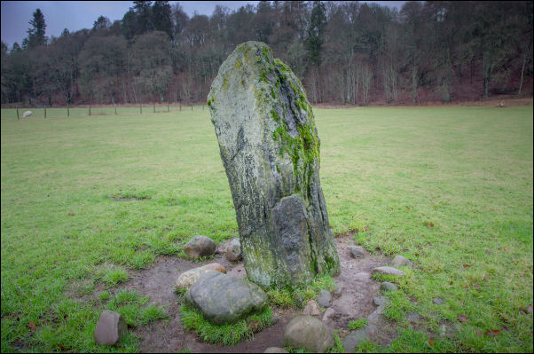
Claverhouse stone where 'Bonnie Dundee' died
|
It
was the first battle in the Jacobite Rising, a religious and
dynastic dispute which finally ended in 1746 at Culloden. The
Jacobites fought to restore the exiled Catholic King James VII
of Scotland and II of England to the British throne in place of
the new Protestant rulers, William and Mary.
The battle
was short but expensive in human life. The dead and wounded on
Mackay's side numbered 2000 and Dundee lost about 800. Although
the Jacobites triumphed at Killiecrankie Dundee was killed
(commander of the Jacobites) and is buried at the Old Blair
Churchyard. |
|
Sat 09 Jan 2016
|
Visited the abandoned clearance village of Rosal.
The
township was situated on the Sutherland estates of the Duke and
Duchess of Sutherland and was cleared between 1814 and 1818 by
Patrick Sellar, the Sutherland estate factor. The inhabitants
were moved to crofts on the coast and their land became part of
a sheep farm rented to Patrick Sellar.
|
|
After the clearances Rosal remained
virtually untouched and, on account of its excellent
preservation, became one of the first historic rural settlement
sites to be investigated in detail. An archaeologist called
Horace Fairhurst carried out excavations at the site in 1962 and
published his findings in 1969.
|
 |
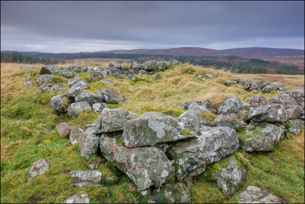
One of the Rosal building remains
|
|
Fri 08 Jan 2016
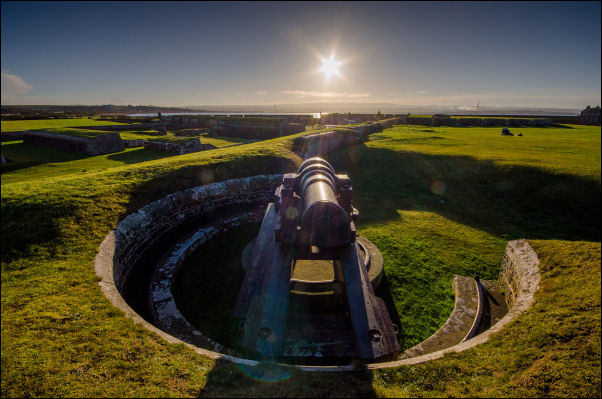
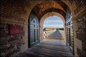
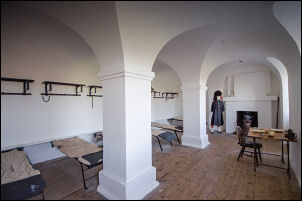
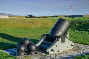
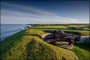
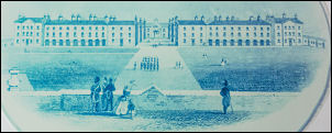
Fort George
|
|
Morning drove to Fort George, NE of Inverness, Scotland.
It
is the finest example of 18th-century military engineering
anywhere in the British Isles.
Strategically positioned on a
promontory jutting into the Moray Firth, the fort was intended
as an impregnable army base. It was designed on a monumental
scale, using sophisticated defence standards, with heavy guns
covering every angle.
The Jacobite Rising of 1745–6 proved to
be the last attempt by the Stewart dynasty to regain the British
throne from the Hanoverians. Following the Battle of Culloden,
just 8 miles (12km) from Fort George, the government introduced
ruthless measures to suppress Jacobite ambitions. Fort George
was one of them, named after King George II (1727–60). It was
designed as the main garrison fortress in the Scottish
Highlands.
Within the boundary walls was accommodation for a
governor, officers, and artillery detachment and a 1,600-strong
infantry garrison. It also housed more than 80 guns, a magazine
for 2,500 gunpowder barrels, ordnance and provision stores, a
brewhouse and a chapel.
Fort George never fired a shot in
anger. Later in the 1700s, after the Jacobite threat had
evaporated, the fort became a recruiting base and training camp
for the rapidly expanding British Army. Many a Highland lad
passed through its gates on his way to fight for the British
Empire across the globe.
|
|

Seen on the drive
|
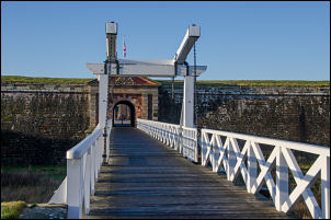
Entrance to the fort |
|
|
|
|
|
|
|
Accommodation under the battlements
|
|
|
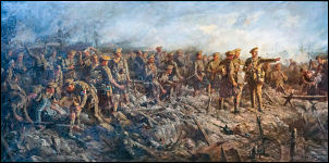
Battle of Loos
Queens own Cameron
Highlanders
26 Sep 1915
|
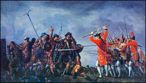
Culloden 1746 |
|
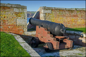
Cannon
|
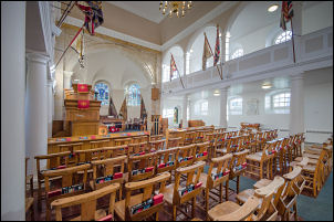
In the chapel |
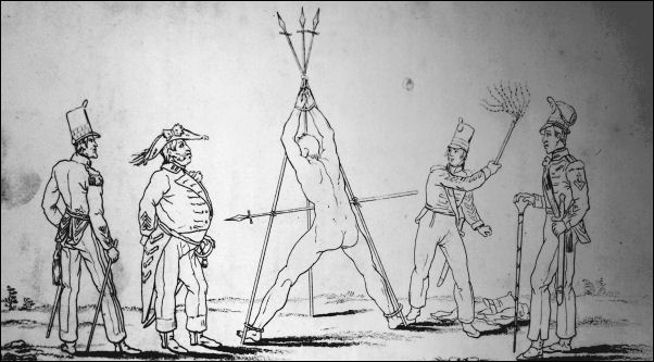
Punishment was brutal
|
|
Main buildings
|
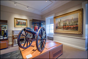
In the museum |
|
After Fort George I drove to Cromarty and had a local walk.
There were many rigs in the area
|
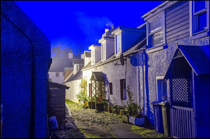
Cromarty |
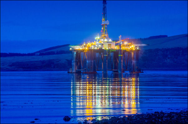
Rig near Nigg across the water
|
|
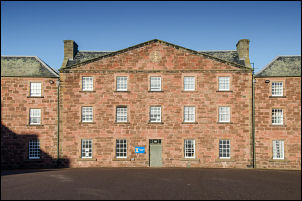
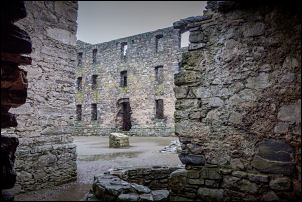
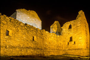
Thu 07 Jan 2016
|
Ruthven Barracks, near Kingussie, Scotland, are the smallest
but best preserved of the four barracks built in 1719 after the
1715 Jacobite rising. Set on an old castle mound,
In August
1745 a unit of 12 British soldiers, commanded by a Sergeant
Terrence Molloy of the 6th Regiment of Foot, defended the
barracks against 200 Jacobites and lost just one man.
|
|
The following year Molloy surrendered to a larger force of
Jacobites, commanded by John Gordon of Glenbucket.
On the day
after the Battle of Culloden in 1746, 3,000 Jacobites retreated
to Fort Ruthven but they were sent home by Prince Charles Edward
Stuart as their situation was hopeless.
The departing
Jacobites destroyed the barracks on 17 April 1746
|
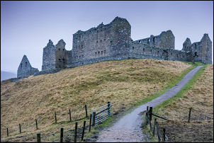 |
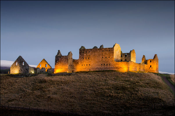
Ruthven Barracks
|
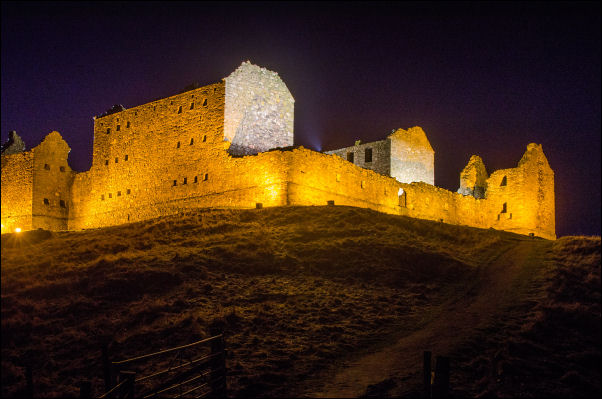
Ruthven Barracks
|
|
|
 |
|
|
|
|
|
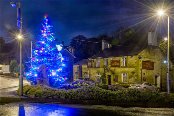
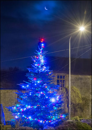
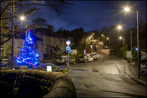
Tue 05 Jan 2016
|
|
The Whittle-le-Woods Christmas tree on Waterhouse Green looked
rather nice this morning so I took a final few photos before it
comes down.
|
 |
 |
|
Sun 03 Jan 2016
|
|
Cycling over to Belmont I saw this
view of
St Peter's across the Blue Lagoon
|
|
Sat 02 Jan 2016
|
Early evening caught the 125 bus to Marley Court near Fredericks
Ice Cream. Joined the Leeds and Liverpool cabal to walk home.
Took several photos of the bridges on the way using my Cree bike
lamp for illumination.
|
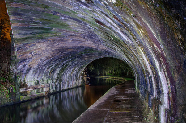
Periwinkle Bridge no 74a carrying the
railway over
|
|
Periwinkle Bridge no 74a
|
M61 Bridge |
|
Botany Bay
|
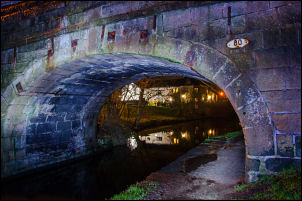
Bridge 80 at Moss Lane,
Whittle-le-Woods. |
|
|
|
|
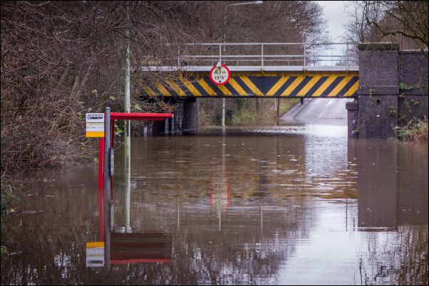
Euxton Lane where the railway crosses
is still flooded
|
|

Cycling through Croston there is still
a lot of damaged house contents around.
|
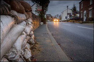
Croston sandbags |
|
Fri 01 Jan 2016
|
From Hurst Hill, Anglezarke I had a great view of the New Year
firework displays across Chorley. Also very noisy from the
exploding fireworks.
|
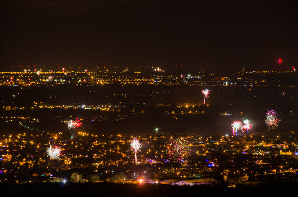
Chorley fireworks.
|
|
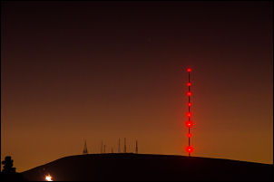
Winter Hill and masts
|
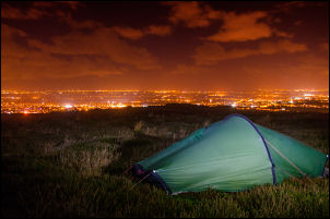
My tent and Chorley at 1am |
|
|
|
|
|
|
|